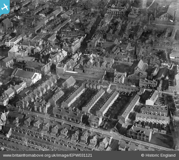
EPW031121 ENGLAND (1929). Cook Street and surroundings, Leigh, 1929
    © Hawlfraint cyfranwyr OpenStreetMap a thrwyddedwyd gan yr OpenStreetMap Foundation. 2025. Trwyddedir y gartograffeg fel CC BY-SA.
  
Delweddau cyfagos (7)
Manylion
| Pennawd | [EPW031121] Cook Street and surroundings, Leigh, 1929 | 
| Cyfeirnod | EPW031121 | 
| Dyddiad | October-1929 | 
| Dolen | |
| Enw lle | LEIGH | 
| Plwyf | |
| Ardal | |
| Gwlad | ENGLAND | 
| Dwyreiniad / Gogleddiad | 365586, 400072 | 
| Hydred / Lledred | -2.5188133843399, 53.495973343649 | 
| Cyfeirnod Grid Cenedlaethol | SD656001 | 
Pinnau
Byddwch y cyntaf i ychwanegu sylw at y ddelwedd hon!
 
             
  ![[EPW031121] Cook Street and surroundings, Leigh, 1929](http://britainfromabove.org.uk/sites/all/libraries/aerofilms-images/public/100x100/EPW/031/EPW031121.jpg) 
  
                                          ![[EPW055097] King Street, Bradshawgate and the town centre, Leigh, 1937](http://britainfromabove.org.uk/sites/all/libraries/aerofilms-images/public/100x100/EPW/055/EPW055097.jpg) 
 ![[EPW031120] The junction of King Street and Bradshawgate and surroundings, Leigh, 1929](http://britainfromabove.org.uk/sites/all/libraries/aerofilms-images/public/100x100/EPW/031/EPW031120.jpg) 
 ![[EPW031118] The King Street Methodist Church and surroundings, Leigh, 1929](http://britainfromabove.org.uk/sites/all/libraries/aerofilms-images/public/100x100/EPW/031/EPW031118.jpg) 
 ![[EPW055092] Market Street, Broadshawgate and the town centre, Leigh, 1937](http://britainfromabove.org.uk/sites/all/libraries/aerofilms-images/public/100x100/EPW/055/EPW055092.jpg) 
 ![[EPW055093] Railway Road and the town, Leigh, 1937](http://britainfromabove.org.uk/sites/all/libraries/aerofilms-images/public/100x100/EPW/055/EPW055093.jpg) 
 ![[EPW031122] St Mary's Church, Leigh, 1929](http://britainfromabove.org.uk/sites/all/libraries/aerofilms-images/public/100x100/EPW/031/EPW031122.jpg)