
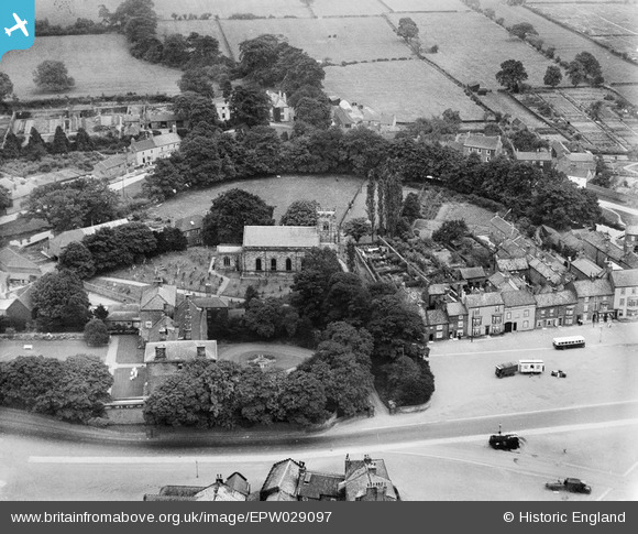
EPW029097 ENGLAND (1929). St Peter's Church and environs, Stokesley, 1929
© Hawlfraint cyfranwyr OpenStreetMap a thrwyddedwyd gan yr OpenStreetMap Foundation. 2026. Trwyddedir y gartograffeg fel CC BY-SA.
Delweddau cyfagos (3)
EPW029097

EPW029099

EPW029095

Manylion
| Pennawd | [EPW029097] St Peter's Church and environs, Stokesley, 1929 |
| Cyfeirnod | EPW029097 |
| Dyddiad | September-1929 |
| Dolen | |
| Enw lle | STOKESLEY |
| Plwyf | STOKESLEY |
| Ardal | |
| Gwlad | ENGLAND |
| Dwyreiniad / Gogleddiad | 452572, 508566 |
| Hydred / Lledred | -1.1887365443545, 54.46960039899 |
| Cyfeirnod Grid Cenedlaethol | NZ526086 |
Pinnau

Aaron |
Tuesday 30th of January 2018 07:50:26 PM | |

Class31 |
Sunday 21st of October 2012 06:13:36 PM | |
|
Class31 |
Sunday 21st of October 2012 06:13:13 PM | |
|
Class31 |
Sunday 21st of October 2012 12:25:14 PM |