
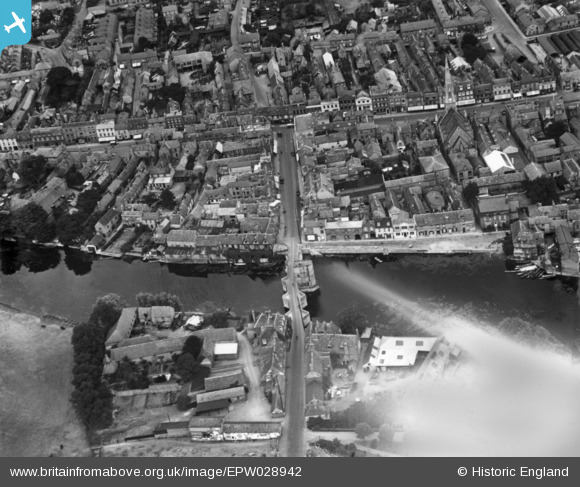
EPW028942 ENGLAND (1929). St Ives Bridge, Bridge Street and environs, St Ives, 1929. This image has been produced from a print affected by flare.
© Hawlfraint cyfranwyr OpenStreetMap a thrwyddedwyd gan yr OpenStreetMap Foundation. 2026. Trwyddedir y gartograffeg fel CC BY-SA.
Delweddau cyfagos (14)
EPW028942

EPW028943

EPW014452

EAW031905

EPW028944

EPW028946

EPW028939

EPW014450

EPW014453

EPW028940

EAW031904

EPW028945

EAW008051

EPW014456

Manylion
| Pennawd | [EPW028942] St Ives Bridge, Bridge Street and environs, St Ives, 1929. This image has been produced from a print affected by flare. |
| Cyfeirnod | EPW028942 |
| Dyddiad | September-1929 |
| Dolen | |
| Enw lle | ST IVES |
| Plwyf | SAINT IVES |
| Ardal | |
| Gwlad | ENGLAND |
| Dwyreiniad / Gogleddiad | 531292, 271188 |
| Hydred / Lledred | -0.073373611761126, 52.322676754971 |
| Cyfeirnod Grid Cenedlaethol | TL313712 |
Pinnau
Byddwch y cyntaf i ychwanegu sylw at y ddelwedd hon!