
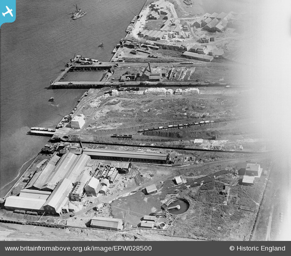
EPW028500 ENGLAND (1929). The Tower Concrete Blocks Works, the Deep Water Pier and tramway system serving the paper mills, Northfleet, 1929
© Hawlfraint cyfranwyr OpenStreetMap a thrwyddedwyd gan yr OpenStreetMap Foundation. 2026. Trwyddedir y gartograffeg fel CC BY-SA.
Delweddau cyfagos (30)
EPW028500

EPW028499

EAW042582

EAW042591

EAW042590

EPW040735

EAW042580

EAW042586

EAW042585

EAW042577

EAW042579

EAW042587

EPW028497

EPW040736

EAW042578

EAW042589

EAW042581

EPW040729

EPW040733

EAW042583

EAW050795

EAW042584

EPW040727

EAW042588

EPW040728

EPW017652
 at Botany Marshes, Northfleet, 1927")
EPW040726

EPW040952

EPW040730

EAW050794

Manylion
| Pennawd | [EPW028500] The Tower Concrete Blocks Works, the Deep Water Pier and tramway system serving the paper mills, Northfleet, 1929 |
| Cyfeirnod | EPW028500 |
| Dyddiad | August-1929 |
| Dolen | |
| Enw lle | NORTHFLEET |
| Plwyf | |
| Ardal | |
| Gwlad | ENGLAND |
| Dwyreiniad / Gogleddiad | 561595, 175208 |
| Hydred / Lledred | 0.32596800478387, 51.45227274955 |
| Cyfeirnod Grid Cenedlaethol | TQ616752 |
Pinnau
Byddwch y cyntaf i ychwanegu sylw at y ddelwedd hon!