
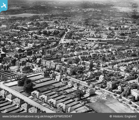
EPW028347 ENGLAND (1929). The town, Bromley, from the east, 1929
© Hawlfraint cyfranwyr OpenStreetMap a thrwyddedwyd gan yr OpenStreetMap Foundation. 2026. Trwyddedir y gartograffeg fel CC BY-SA.
Delweddau cyfagos (3)
EPW028347

EPW028345

EPW028353

Manylion
| Pennawd | [EPW028347] The town, Bromley, from the east, 1929 |
| Cyfeirnod | EPW028347 |
| Dyddiad | August-1929 |
| Dolen | |
| Enw lle | BROMLEY |
| Plwyf | |
| Ardal | |
| Gwlad | ENGLAND |
| Dwyreiniad / Gogleddiad | 540708, 169471 |
| Hydred / Lledred | 0.023261797564517, 51.406291588816 |
| Cyfeirnod Grid Cenedlaethol | TQ407695 |
