
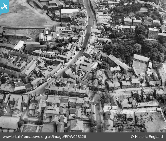
EPW028126 ENGLAND (1929). Bridge Street and environs, Congleton, 1929
© Hawlfraint cyfranwyr OpenStreetMap a thrwyddedwyd gan yr OpenStreetMap Foundation. 2026. Trwyddedir y gartograffeg fel CC BY-SA.
Delweddau cyfagos (3)
EPW028126

EPW028124

EPW028121

Manylion
| Pennawd | [EPW028126] Bridge Street and environs, Congleton, 1929 |
| Cyfeirnod | EPW028126 |
| Dyddiad | July-1929 |
| Dolen | |
| Enw lle | CONGLETON |
| Plwyf | CONGLETON |
| Ardal | |
| Gwlad | ENGLAND |
| Dwyreiniad / Gogleddiad | 385791, 362931 |
| Hydred / Lledred | -2.2125478308945, 53.163022469792 |
| Cyfeirnod Grid Cenedlaethol | SJ858629 |
Pinnau
Byddwch y cyntaf i ychwanegu sylw at y ddelwedd hon!