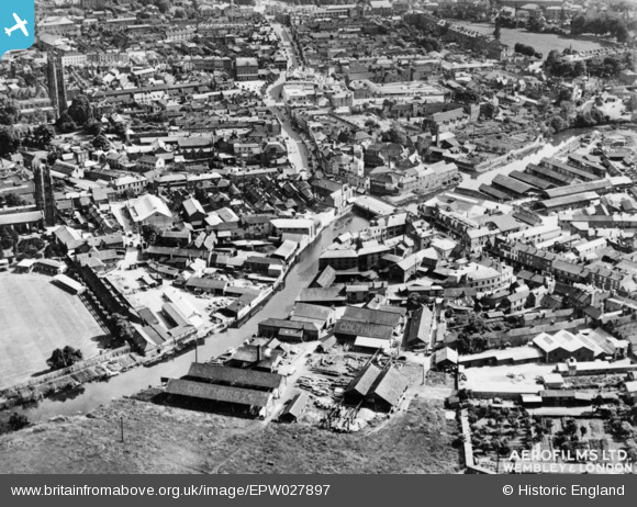
EPW027897 ENGLAND (1929). Tone Bridge and the town centre, 1929. This image has been produced from a copy-negative.
    © Hawlfraint cyfranwyr OpenStreetMap a thrwyddedwyd gan yr OpenStreetMap Foundation. 2025. Trwyddedir y gartograffeg fel CC BY-SA.
  
Delweddau cyfagos (9)
Manylion
| Pennawd | [EPW027897] Tone Bridge and the town centre, 1929. This image has been produced from a copy-negative. | 
| Cyfeirnod | EPW027897 | 
| Dyddiad | 28-July-1929 | 
| Dolen | |
| Enw lle | TAUNTON | 
| Plwyf | |
| Ardal | |
| Gwlad | ENGLAND | 
| Dwyreiniad / Gogleddiad | 322701, 124865 | 
| Hydred / Lledred | -3.1021349201241, 51.017420014091 | 
| Cyfeirnod Grid Cenedlaethol | ST227249 | 
Pinnau
|  Swimming pool |   Somerset Chick | Sunday 19th of March 2017 12:27:31 AM | 
|  The Turks Head pub |   Somerset Chick | Sunday 19th of March 2017 12:26:42 AM | 
|  Colthurst timber yard |   Somerset Chick | Sunday 19th of March 2017 12:25:45 AM | 
|  The Parade |   Somerset Chick | Thursday 15th of September 2016 05:01:10 PM | 
|  Somerset County Cricket Ground |   Somerset Chick | Thursday 15th of September 2016 05:00:38 PM | 
 
             
  ![[EPW027897] Tone Bridge and the town centre, 1929. This image has been produced from a copy-negative.](http://britainfromabove.org.uk/sites/all/libraries/aerofilms-images/public/100x100/EPW/027/EPW027897.jpg) 
  
                                          ![[EPW027895] Tone Bridge, Taunton, 1929. This image has been produced from a print.](http://britainfromabove.org.uk/sites/all/libraries/aerofilms-images/public/100x100/EPW/027/EPW027895.jpg) 
 ![[EPW013543] Tone Bridge and environs, Taunton, 1925. This image has been produced from a copy-negative.](http://britainfromabove.org.uk/sites/all/libraries/aerofilms-images/public/100x100/EPW/013/EPW013543.jpg) 
 ![[EAW005338] The remains of Taunton Castle and environs, Taunton, 1947. This image has been produced from a print.](http://britainfromabove.org.uk/sites/all/libraries/aerofilms-images/public/100x100/EAW/005/EAW005338.jpg) 
 ![[EAW005339] The remains of Taunton Castle and environs, Taunton, 1947. This image has been produced from a print.](http://britainfromabove.org.uk/sites/all/libraries/aerofilms-images/public/100x100/EAW/005/EAW005339.jpg) 
 ![[EAW005341] The remains of Taunton Castle, Taunton, 1947](http://britainfromabove.org.uk/sites/all/libraries/aerofilms-images/public/100x100/EAW/005/EAW005341.jpg) 
 ![[EPW027896] The junction of Staplegrove Road and Station Road, Taunton, 1929. This image has been produced from a print.](http://britainfromabove.org.uk/sites/all/libraries/aerofilms-images/public/100x100/EPW/027/EPW027896.jpg) 
 ![[EAW005337] The remains of Taunton Castle, Taunton, 1947. This image has been produced from a print.](http://britainfromabove.org.uk/sites/all/libraries/aerofilms-images/public/100x100/EAW/005/EAW005337.jpg) 
 ![[EAW005340] The remains of Taunton Castle, Taunton, 1947](http://britainfromabove.org.uk/sites/all/libraries/aerofilms-images/public/100x100/EAW/005/EAW005340.jpg)