
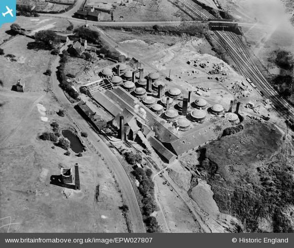
EPW027807 ENGLAND (1929). The Knutton Tileries, Silverdale, 1929
© Hawlfraint cyfranwyr OpenStreetMap a thrwyddedwyd gan yr OpenStreetMap Foundation. 2026. Trwyddedir y gartograffeg fel CC BY-SA.
Delweddau cyfagos (11)
EPW027807

EPW038476

EPW043654

EPW038480

EPW043652

EPW038481

EPW027808

EPW043655

EPW038477

EPW038478

EPW043656

Manylion
| Pennawd | [EPW027807] The Knutton Tileries, Silverdale, 1929 |
| Cyfeirnod | EPW027807 |
| Dyddiad | June-1929 |
| Dolen | |
| Enw lle | SILVERDALE |
| Plwyf | SILVERDALE |
| Ardal | |
| Gwlad | ENGLAND |
| Dwyreiniad / Gogleddiad | 383020, 346676 |
| Hydred / Lledred | -2.2531389494156, 53.016808956613 |
| Cyfeirnod Grid Cenedlaethol | SJ830467 |
Pinnau

tarboat |
Friday 23rd of February 2024 05:33:13 PM | |
|
dee |
Sunday 8th of February 2015 04:20:06 AM | |
|
dee |
Sunday 8th of February 2015 04:15:58 AM | |
|
dee |
Sunday 8th of February 2015 03:48:45 AM | |

bescotbeast |
Sunday 2nd of March 2014 01:29:43 AM |