
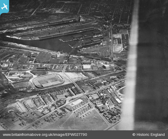
EPW027790 ENGLAND (1929). manchester United Football Ground (Old Trafford) and Salford Docks, Trafford Park, 1929. This image has been produced from a copy-negative.
© Hawlfraint cyfranwyr OpenStreetMap a thrwyddedwyd gan yr OpenStreetMap Foundation. 2026. Trwyddedir y gartograffeg fel CC BY-SA.
Delweddau cyfagos (13)
EPW027790
 and Salford Docks, Trafford Park, 1929. This image has been produced from a copy-negative.")
EPW045978

EPW045977

EPW045982

EPW017590

EPW017592

EPW045979

EPW045976

EPW017593

EPW045980

EPW017595

EPW017589

EPW045981

Manylion
| Pennawd | [EPW027790] manchester United Football Ground (Old Trafford) and Salford Docks, Trafford Park, 1929. This image has been produced from a copy-negative. |
| Cyfeirnod | EPW027790 |
| Dyddiad | June-1929 |
| Dolen | |
| Enw lle | TRAFFORD PARK |
| Plwyf | |
| Ardal | |
| Gwlad | ENGLAND |
| Dwyreiniad / Gogleddiad | 381013, 396470 |
| Hydred / Lledred | -2.286027967626, 53.464376753464 |
| Cyfeirnod Grid Cenedlaethol | SJ810965 |
Pinnau
Byddwch y cyntaf i ychwanegu sylw at y ddelwedd hon!