
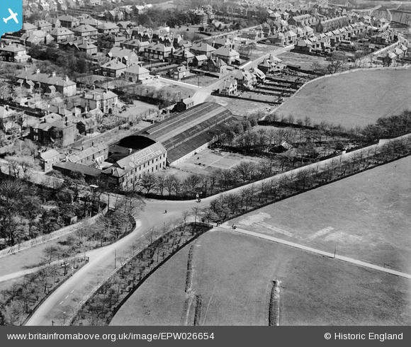
EPW026654 ENGLAND (1929). Lawson's Confectionery Works, Newcastle upon Tyne, 1929
© Hawlfraint cyfranwyr OpenStreetMap a thrwyddedwyd gan yr OpenStreetMap Foundation. 2026. Trwyddedir y gartograffeg fel CC BY-SA.
Delweddau cyfagos (3)
EPW026654

EPW026652

EPW026653

Manylion
| Pennawd | [EPW026654] Lawson's Confectionery Works, Newcastle upon Tyne, 1929 |
| Cyfeirnod | EPW026654 |
| Dyddiad | May-1929 |
| Dolen | |
| Enw lle | NEWCASTLE UPON TYNE |
| Plwyf | |
| Ardal | |
| Gwlad | ENGLAND |
| Dwyreiniad / Gogleddiad | 423904, 566828 |
| Hydred / Lledred | -1.6263221075369, 54.995385386914 |
| Cyfeirnod Grid Cenedlaethol | NZ239668 |
Pinnau

Arpster |
Thursday 14th of February 2013 02:33:21 PM | |
|
Arpster |
Thursday 14th of February 2013 02:29:12 PM |