
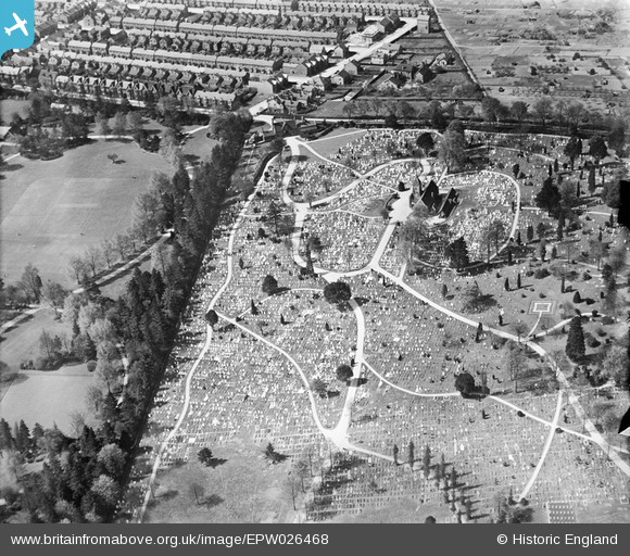
EPW026468 ENGLAND (1929). The Cemetery, Bedford, 1929
© Hawlfraint cyfranwyr OpenStreetMap a thrwyddedwyd gan yr OpenStreetMap Foundation. 2026. Trwyddedir y gartograffeg fel CC BY-SA.
Delweddau cyfagos (2)
EPW026468

EPW022389

Manylion
| Pennawd | [EPW026468] The Cemetery, Bedford, 1929 |
| Cyfeirnod | EPW026468 |
| Dyddiad | May-1929 |
| Dolen | |
| Enw lle | BEDFORD |
| Plwyf | |
| Ardal | |
| Gwlad | ENGLAND |
| Dwyreiniad / Gogleddiad | 504904, 251135 |
| Hydred / Lledred | -0.46665548566414, 52.148117085374 |
| Cyfeirnod Grid Cenedlaethol | TL049511 |
Pinnau

BallisticBerry |
Thursday 9th of April 2020 04:32:07 PM | |
|
D Park |
Friday 23rd of August 2013 04:16:52 PM | |

Class31 |
Saturday 27th of October 2012 06:01:27 PM | |
|
Class31 |
Saturday 27th of October 2012 06:01:02 PM | |
|
Class31 |
Saturday 27th of October 2012 06:00:36 PM | |
|
Class31 |
Saturday 27th of October 2012 06:00:16 PM | |
|
Class31 |
Saturday 27th of October 2012 05:59:41 PM | |
|
Class31 |
Saturday 27th of October 2012 05:59:08 PM |