
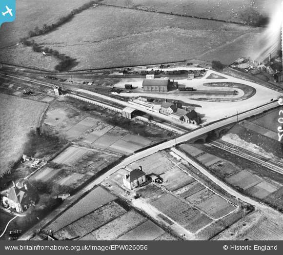
EPW026056 ENGLAND (1929). Charing railway station and environs, Charing, 1929
© Hawlfraint cyfranwyr OpenStreetMap a thrwyddedwyd gan yr OpenStreetMap Foundation. 2026. Trwyddedir y gartograffeg fel CC BY-SA.
Delweddau cyfagos (3)
EPW026056

EPW026059

EPW038122
 and environs, Charing, 1932")
Manylion
| Pennawd | [EPW026056] Charing railway station and environs, Charing, 1929 |
| Cyfeirnod | EPW026056 |
| Dyddiad | April-1929 |
| Dolen | |
| Enw lle | CHARING |
| Plwyf | CHARING |
| Ardal | |
| Gwlad | ENGLAND |
| Dwyreiniad / Gogleddiad | 594971, 149129 |
| Hydred / Lledred | 0.79154124819077, 51.207522208356 |
| Cyfeirnod Grid Cenedlaethol | TQ950491 |
Pinnau

Kent Navigator |
Friday 20th of October 2017 06:07:10 PM | |

Billy Turner |
Monday 18th of January 2016 02:45:31 PM |
