
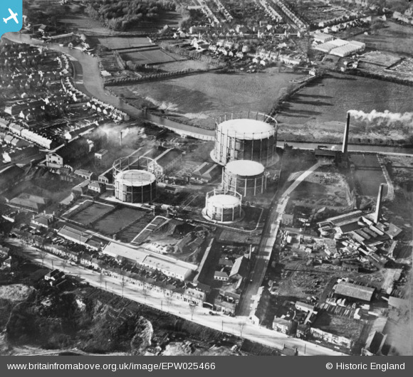
EPW025466 ENGLAND (1928). The Gas Works between River Lane and Cheddar's Lane, Cambridge, 1928. This image has been produced from a copy-negative.
© Hawlfraint cyfranwyr OpenStreetMap a thrwyddedwyd gan yr OpenStreetMap Foundation. 2026. Trwyddedir y gartograffeg fel CC BY-SA.
Delweddau cyfagos (7)
EPW025466

EPW041310

EPW041309

EPW041308

EPW041311

EPW041312

EPW041307

Manylion
| Pennawd | [EPW025466] The Gas Works between River Lane and Cheddar's Lane, Cambridge, 1928. This image has been produced from a copy-negative. |
| Cyfeirnod | EPW025466 |
| Dyddiad | 14-November-1928 |
| Dolen | |
| Enw lle | CAMBRIDGE |
| Plwyf | |
| Ardal | |
| Gwlad | ENGLAND |
| Dwyreiniad / Gogleddiad | 546544, 259202 |
| Hydred / Lledred | 0.14507188190319, 52.211121781619 |
| Cyfeirnod Grid Cenedlaethol | TL465592 |
Pinnau

John W |
Friday 21st of October 2016 08:55:40 PM |