
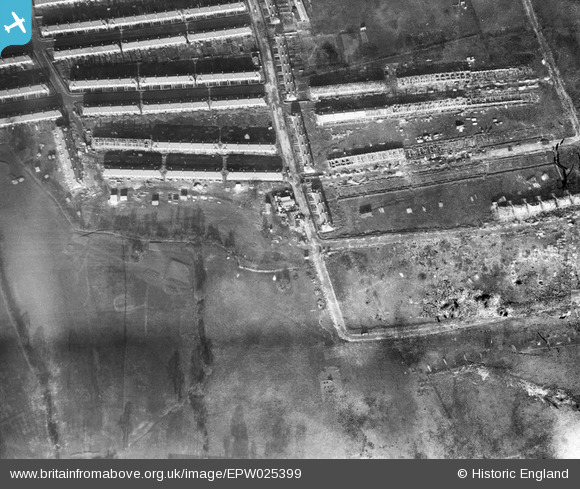
EPW025399 ENGLAND (1928). A new housing estate on the North Circular Road by the Brent Reservoir, Dollis Hill, 1928. This image has been produced from a damaged negative.
© Hawlfraint cyfranwyr OpenStreetMap a thrwyddedwyd gan yr OpenStreetMap Foundation. 2026. Trwyddedir y gartograffeg fel CC BY-SA.
Delweddau cyfagos (6)
EPW025399

EPW025412

EPW021257

EPW025413

EPW025415

EPW025416

Manylion
| Pennawd | [EPW025399] A new housing estate on the North Circular Road by the Brent Reservoir, Dollis Hill, 1928. This image has been produced from a damaged negative. |
| Cyfeirnod | EPW025399 |
| Dyddiad | 9-November-1928 |
| Dolen | |
| Enw lle | DOLLIS HILL |
| Plwyf | |
| Ardal | |
| Gwlad | ENGLAND |
| Dwyreiniad / Gogleddiad | 522108, 186563 |
| Hydred / Lledred | -0.23813233743831, 51.564230214504 |
| Cyfeirnod Grid Cenedlaethol | TQ221866 |
Pinnau
Byddwch y cyntaf i ychwanegu sylw at y ddelwedd hon!