
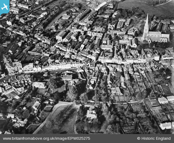
EPW025275 ENGLAND (1928). The town centre, Dorking, 1928. This image has been produced from a copy-negative.
© Hawlfraint cyfranwyr OpenStreetMap a thrwyddedwyd gan yr OpenStreetMap Foundation. 2026. Trwyddedir y gartograffeg fel CC BY-SA.
Delweddau cyfagos (12)
EPW025275

EPW057020

EPW025274

EAW042716

EPW001616

EPW053878

EAW042713

EPW053877

EPW025273

EAW042715

EPW057017

EPW006291

Manylion
| Pennawd | [EPW025275] The town centre, Dorking, 1928. This image has been produced from a copy-negative. |
| Cyfeirnod | EPW025275 |
| Dyddiad | October-1928 |
| Dolen | |
| Enw lle | DORKING |
| Plwyf | |
| Ardal | |
| Gwlad | ENGLAND |
| Dwyreiniad / Gogleddiad | 516482, 149337 |
| Hydred / Lledred | -0.33149212416289, 51.230802794463 |
| Cyfeirnod Grid Cenedlaethol | TQ165493 |
