
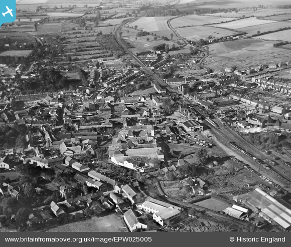
EPW025005 ENGLAND (1928). Malthouses on the River Gipping and the town, Stowmarket, from the south-east, 1928
© Hawlfraint cyfranwyr OpenStreetMap a thrwyddedwyd gan yr OpenStreetMap Foundation. 2026. Trwyddedir y gartograffeg fel CC BY-SA.
Delweddau cyfagos (2)
EPW025005

EPW025004

Manylion
| Pennawd | [EPW025005] Malthouses on the River Gipping and the town, Stowmarket, from the south-east, 1928 |
| Cyfeirnod | EPW025005 |
| Dyddiad | 9-October-1928 |
| Dolen | |
| Enw lle | STOWMARKET |
| Plwyf | STOWMARKET |
| Ardal | |
| Gwlad | ENGLAND |
| Dwyreiniad / Gogleddiad | 605146, 258651 |
| Hydred / Lledred | 1.0014453378076, 52.187479682938 |
| Cyfeirnod Grid Cenedlaethol | TM051587 |
Pinnau

F |
Sunday 23rd of April 2023 09:13:55 AM | |
|
F |
Sunday 23rd of April 2023 09:13:25 AM | |
|
Skelly |
Thursday 24th of December 2020 01:32:31 AM | |
|
John W |
Saturday 21st of January 2017 03:47:49 PM | |
|
TreasRGT |
Monday 6th of October 2014 01:25:53 PM | |
Actually the Ipswich and Stowmarket Navigation. Opened 1793, mostly using the River Gipping. Traffic to Stowmarket stopped around 1910, and the navigation was abandoned in 1932. (Information from "Lost Canals and Waterways of Britain", by Ronald Russell, published by David and Charles.) |
John W |
Saturday 21st of January 2017 03:46:48 PM |