
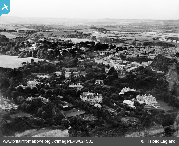
EPW024581 ENGLAND (1928). The town and surroundings, Shanklin, from the south-east, 1928
© Hawlfraint cyfranwyr OpenStreetMap a thrwyddedwyd gan yr OpenStreetMap Foundation. 2026. Trwyddedir y gartograffeg fel CC BY-SA.
Delweddau cyfagos (6)
EPW024581

EPW024568

EPW024575

EPW024569

EPW022914

EPW039649

Manylion
| Pennawd | [EPW024581] The town and surroundings, Shanklin, from the south-east, 1928 |
| Cyfeirnod | EPW024581 |
| Dyddiad | September-1928 |
| Dolen | |
| Enw lle | SHANKLIN |
| Plwyf | SHANKLIN |
| Ardal | |
| Gwlad | ENGLAND |
| Dwyreiniad / Gogleddiad | 458360, 80750 |
| Hydred / Lledred | -1.1748850094983, 50.622945753402 |
| Cyfeirnod Grid Cenedlaethol | SZ584808 |
Pinnau
Byddwch y cyntaf i ychwanegu sylw at y ddelwedd hon!