
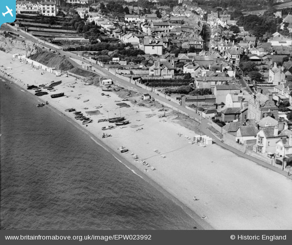
EPW023992 ENGLAND (1928). Cliff Path and environs, Budleigh Salterton, 1928
© Hawlfraint cyfranwyr OpenStreetMap a thrwyddedwyd gan yr OpenStreetMap Foundation. 2026. Trwyddedir y gartograffeg fel CC BY-SA.
Delweddau cyfagos (4)
EPW023992

EPW023995

EPW033491

EPW033492

Manylion
| Pennawd | [EPW023992] Cliff Path and environs, Budleigh Salterton, 1928 |
| Cyfeirnod | EPW023992 |
| Dyddiad | September-1928 |
| Dolen | |
| Enw lle | BUDLEIGH SALTERTON |
| Plwyf | BUDLEIGH SALTERTON |
| Ardal | |
| Gwlad | ENGLAND |
| Dwyreiniad / Gogleddiad | 306521, 81815 |
| Hydred / Lledred | -3.3217943819454, 50.627948346158 |
| Cyfeirnod Grid Cenedlaethol | SY065818 |
Pinnau
Byddwch y cyntaf i ychwanegu sylw at y ddelwedd hon!