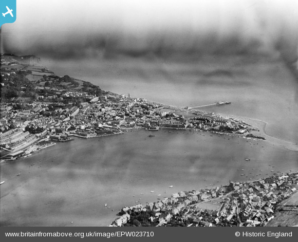
EPW023710 ENGLAND (1928). The town, Teignmouth, from the south-west, 1928
© Hawlfraint cyfranwyr OpenStreetMap a thrwyddedwyd gan yr OpenStreetMap Foundation. 2026. Trwyddedir y gartograffeg fel CC BY-SA.
Manylion
| Pennawd | [EPW023710] The town, Teignmouth, from the south-west, 1928 |
| Cyfeirnod | EPW023710 |
| Dyddiad | September-1928 |
| Dolen | |
| Enw lle | TEIGNMOUTH |
| Plwyf | TEIGNMOUTH |
| Ardal | |
| Gwlad | ENGLAND |
| Dwyreiniad / Gogleddiad | 293797, 72725 |
| Hydred / Lledred | -3.4990524441897, 50.544042226866 |
| Cyfeirnod Grid Cenedlaethol | SX938727 |


![[EPW023710] The town, Teignmouth, from the south-west, 1928](http://britainfromabove.org.uk/sites/all/libraries/aerofilms-images/public/100x100/EPW/023/EPW023710.jpg)
![[EPW033441] The town, Teignmouth, 1930](http://britainfromabove.org.uk/sites/all/libraries/aerofilms-images/public/100x100/EPW/033/EPW033441.jpg)
![[EPW033437] The New Quay, The Den and the town, Teignmouth, 1930](http://britainfromabove.org.uk/sites/all/libraries/aerofilms-images/public/100x100/EPW/033/EPW033437.jpg)

