
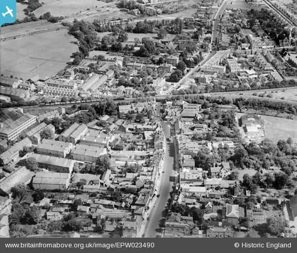
EPW023490 ENGLAND (1928). High Street and surroundings, Staines, 1928
© Hawlfraint cyfranwyr OpenStreetMap a thrwyddedwyd gan yr OpenStreetMap Foundation. 2026. Trwyddedir y gartograffeg fel CC BY-SA.
Delweddau cyfagos (18)
EPW023490

EPW023486

EPW023477

EPW061672

EPW023481

EPW061669

EPW023480

EPW009569

EPW023473

EPW061665

EPW023478

EPW023491

EPW009567

EPW023488

EPW023472

EPW023471

EPW009570

EPW023475

Manylion
| Pennawd | [EPW023490] High Street and surroundings, Staines, 1928 |
| Cyfeirnod | EPW023490 |
| Dyddiad | September-1928 |
| Dolen | |
| Enw lle | STAINES |
| Plwyf | |
| Ardal | |
| Gwlad | ENGLAND |
| Dwyreiniad / Gogleddiad | 503694, 171706 |
| Hydred / Lledred | -0.50808565708961, 51.434361490924 |
| Cyfeirnod Grid Cenedlaethol | TQ037717 |


