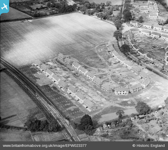
EPW023377 ENGLAND (1928). New housing under construction at Pyrcroft Road, Chertsey, 1928
    © Hawlfraint cyfranwyr OpenStreetMap a thrwyddedwyd gan yr OpenStreetMap Foundation. 2025. Trwyddedir y gartograffeg fel CC BY-SA.
  
Manylion
| Pennawd | [EPW023377] New housing under construction at Pyrcroft Road, Chertsey, 1928 | 
| Cyfeirnod | EPW023377 | 
| Dyddiad | October-1928 | 
| Dolen | |
| Enw lle | CHERTSEY | 
| Plwyf | |
| Ardal | |
| Gwlad | ENGLAND | 
| Dwyreiniad / Gogleddiad | 503631, 166569 | 
| Hydred / Lledred | -0.5104933997657, 51.388193452152 | 
| Cyfeirnod Grid Cenedlaethol | TQ036666 | 
Pinnau
Byddwch y cyntaf i ychwanegu sylw at y ddelwedd hon!
 
             
  ![[EPW023377] New housing under construction at Pyrcroft Road, Chertsey, 1928](http://britainfromabove.org.uk/sites/all/libraries/aerofilms-images/public/100x100/EPW/023/EPW023377.jpg) 
  
                                          ![[EPW026274] New houses under construction at Pyrcroft Road, Lasswade Road and Barker Road, Chertsey, 1929](http://britainfromabove.org.uk/sites/all/libraries/aerofilms-images/public/100x100/EPW/026/EPW026274.jpg) 
 ![[EPW026278] Eastworth, Chertsey, from the north-west, 1929](http://britainfromabove.org.uk/sites/all/libraries/aerofilms-images/public/100x100/EPW/026/EPW026278.jpg) 
 ![[EPW023380] Chertsey Railway Station and environs, Chertsey, 1928](http://britainfromabove.org.uk/sites/all/libraries/aerofilms-images/public/100x100/EPW/023/EPW023380.jpg)