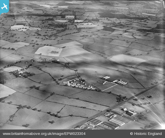
EPW023304 ENGLAND (1928). The Chatwood Safe Co and environs, Harlescott, from the south-east, 1928

© Hawlfraint cyfranwyr OpenStreetMap a thrwyddedwyd gan yr OpenStreetMap Foundation. 2025. Trwyddedir y gartograffeg fel CC BY-SA.

Delweddau cyfagos (35)

EPW023304
  0° 0m
EPW023303
  41° 104m
EAW001109
  304° 108m
EAW001619
  69° 114m
EAW000399
  44° 115m
EAW001623
  13° 132m
EPW023301
  29° 133m
EAW001106
  5° 143m
EAW001107
  354° 155m
EAW001621
  7° 156m
EAW001620
  53° 160m
EAW000395
  35° 161m
EAW000396
  4° 169m
EAW001627
  67° 169m
EAW001110
  358° 184m
EAW000397
  6° 189m
EPW023300
  24° 191m
EAW000398
  21° 200m
EPW023305
  100° 205m
EAW001622
  27° 224m
EAW001624
  14° 227m
EAW000393
  311° 228m
EPW028831
  47° 236m
EAW001626
  20° 240m
EPW023336
  40° 245m
EAW001625
  14° 248m
EPW028835
  24° 250m
EAW001111
  45° 259m
EPW028840
  50° 261m
EPW028833
  28° 265m
EPW028841
  41° 277m
EPW023334
  46° 302m
EPW028837
  38° 312m
EPW023337
  49° 313m
EPW023339
  40° 319m

Manylion

Pennawd [EPW023304] The Chatwood Safe Co and environs, Harlescott, from the south-east, 1928
Cyfeirnod EPW023304
Dyddiad September-1928
Dolen
Enw lle HARLESCOTT
Plwyf SHREWSBURY
Ardal
Gwlad ENGLAND
Dwyreiniad / Gogleddiad 350590, 315933
Hydred / Lledred -2.7319103803539, 52.738428203055
Cyfeirnod Grid Cenedlaethol SJ506159

Pinnau

The Moat, Harlescott Grange. Earthwork and buried remains of a medieval moated site, situated on a gentle north east facing slope. It is now surrounded by a modern housing estate, but from this location there would originally have been extensive views of the surrounding area. The moat is now visible as a slight earthwork having been drained in 1950 and largely infilled following the construction of the housing estate. The arms of the moat, which survive as buried features, are between 12m and 15m wide and define a rectangular island approximately 40m by 46m. Material excavated from the moat has been used to raise the surface of the island between 1.2m and 2m above the level of the surrounding ground. An account of the site in 1937 indicated that the sides of the moat were lined with masonry and when the moat was drained, 13th century pottery was found. Sherds of medieval pottery were also found when a small-scale archaeological excavation was conducted in 1960. https://historicengland.org.uk/listing/the-list/list-entry/1019297

mymuk
Tuesday 17th of April 2018 01:02:08 PM