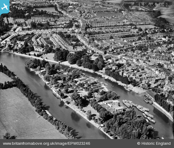
EPW023246 ENGLAND (1928). Eel Pie Island and surroundings, Twickenham, 1928
© Hawlfraint cyfranwyr OpenStreetMap a thrwyddedwyd gan yr OpenStreetMap Foundation. 2026. Trwyddedir y gartograffeg fel CC BY-SA.
Delweddau cyfagos (8)
Manylion
| Pennawd | [EPW023246] Eel Pie Island and surroundings, Twickenham, 1928 |
| Cyfeirnod | EPW023246 |
| Dyddiad | September-1928 |
| Dolen | |
| Enw lle | TWICKENHAM |
| Plwyf | |
| Ardal | |
| Gwlad | ENGLAND |
| Dwyreiniad / Gogleddiad | 516338, 173157 |
| Hydred / Lledred | -0.32577004403126, 51.444948517571 |
| Cyfeirnod Grid Cenedlaethol | TQ163732 |
Pinnau

Leslie B |
Saturday 16th of December 2023 04:04:05 PM | |

Brian |
Saturday 14th of February 2015 05:01:52 PM | |

Brian |
Saturday 14th of February 2015 04:28:09 PM | |

Arty |
Friday 13th of July 2012 05:08:23 PM | |

Arty |
Friday 13th of July 2012 05:07:48 PM | |

Arty |
Friday 13th of July 2012 05:06:12 PM | |

Arty |
Friday 13th of July 2012 05:05:36 PM | |

Arty |
Friday 13th of July 2012 05:03:47 PM |


![[EPW023246] Eel Pie Island and surroundings, Twickenham, 1928](http://britainfromabove.org.uk/sites/all/libraries/aerofilms-images/public/100x100/EPW/023/EPW023246.jpg)
![[EPW023239] Eel Pie Island and The Embankment, Twickenham, 1928](http://britainfromabove.org.uk/sites/all/libraries/aerofilms-images/public/100x100/EPW/023/EPW023239.jpg)
![[EAW025281] Eel Pie Island, Twickenham, 1949](http://britainfromabove.org.uk/sites/all/libraries/aerofilms-images/public/100x100/EAW/025/EAW025281.jpg)
![[EAW025280] Eel Pie Island, Twickenham, 1949](http://britainfromabove.org.uk/sites/all/libraries/aerofilms-images/public/100x100/EAW/025/EAW025280.jpg)
![[EPW022846] Eel Pie Island, Twickenham, 1928](http://britainfromabove.org.uk/sites/all/libraries/aerofilms-images/public/100x100/EPW/022/EPW022846.jpg)
![[EPW023238] King Street, Twickenham, 1928](http://britainfromabove.org.uk/sites/all/libraries/aerofilms-images/public/100x100/EPW/023/EPW023238.jpg)
![[EPR000467] Thames Eyot and the River Thames at Eeel Pie Island, Twickenham, 1935](http://britainfromabove.org.uk/sites/all/libraries/aerofilms-images/public/100x100/EPR/000/EPR000467.jpg)
![[EAW025282] Eel Pie Island, Twickenham, 1949](http://britainfromabove.org.uk/sites/all/libraries/aerofilms-images/public/100x100/EAW/025/EAW025282.jpg)
