
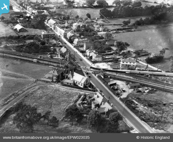
EPW023035 ENGLAND (1928). The level crossing on West Street, Havant, 1928. This image has been produced from a damaged print.
© Hawlfraint cyfranwyr OpenStreetMap a thrwyddedwyd gan yr OpenStreetMap Foundation. 2026. Trwyddedir y gartograffeg fel CC BY-SA.
Delweddau cyfagos (3)
EPW023035

EPW023033

EPW023030

Manylion
| Pennawd | [EPW023035] The level crossing on West Street, Havant, 1928. This image has been produced from a damaged print. |
| Cyfeirnod | EPW023035 |
| Dyddiad | August-1928 |
| Dolen | |
| Enw lle | HAVANT |
| Plwyf | |
| Ardal | |
| Gwlad | ENGLAND |
| Dwyreiniad / Gogleddiad | 470785, 106551 |
| Hydred / Lledred | -0.9942846981335, 50.853579840542 |
| Cyfeirnod Grid Cenedlaethol | SU708066 |
Pinnau

Mr Nozzle |
Thursday 13th of November 2014 01:25:43 PM |