
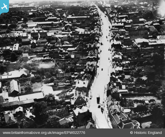
EPW022776 ENGLAND (1928). High Street, Uxbridge, 1928. This image has been produced from a print.
© Hawlfraint cyfranwyr OpenStreetMap a thrwyddedwyd gan yr OpenStreetMap Foundation. 2026. Trwyddedir y gartograffeg fel CC BY-SA.
Delweddau cyfagos (7)
EPW022776

EPW022771

EPW001578

EPW031258

EPW041117

EPW031256

EPW041116

Manylion
| Pennawd | [EPW022776] High Street, Uxbridge, 1928. This image has been produced from a print. |
| Cyfeirnod | EPW022776 |
| Dyddiad | August-1928 |
| Dolen | |
| Enw lle | UXBRIDGE |
| Plwyf | |
| Ardal | |
| Gwlad | ENGLAND |
| Dwyreiniad / Gogleddiad | 505435, 184363 |
| Hydred / Lledred | -0.47926448255677, 51.547818410213 |
| Cyfeirnod Grid Cenedlaethol | TQ054844 |
