
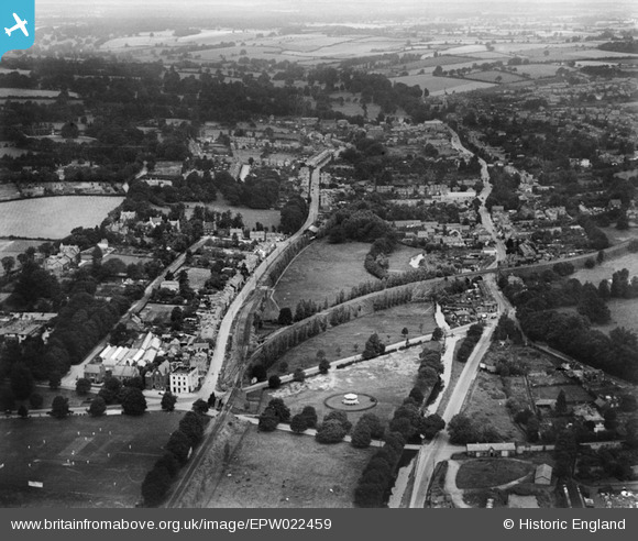
EPW022459 ENGLAND (1928). Cotterells and environs, Hemel Hempstead, from the south-east, 1928
© Hawlfraint cyfranwyr OpenStreetMap a thrwyddedwyd gan yr OpenStreetMap Foundation. 2026. Trwyddedir y gartograffeg fel CC BY-SA.
Delweddau cyfagos (2)
EPW022459

EPW052864

Manylion
| Pennawd | [EPW022459] Cotterells and environs, Hemel Hempstead, from the south-east, 1928 |
| Cyfeirnod | EPW022459 |
| Dyddiad | 9-August-1928 |
| Dolen | |
| Enw lle | HEMEL HEMPSTEAD |
| Plwyf | |
| Ardal | |
| Gwlad | ENGLAND |
| Dwyreiniad / Gogleddiad | 505399, 206239 |
| Hydred / Lledred | -0.47319089145038, 51.744470705011 |
| Cyfeirnod Grid Cenedlaethol | TL054062 |
Pinnau

H.E. |
Saturday 24th of April 2021 03:27:45 PM | |

downloader141 |
Thursday 4th of October 2018 10:43:49 AM | |
|
downloader141 |
Thursday 4th of October 2018 10:43:28 AM | |
|
H.E. |
Tuesday 13th of January 2015 02:11:18 PM | |
|
H.E. |
Tuesday 13th of January 2015 02:08:53 PM | |
|
H.E. |
Tuesday 13th of January 2015 02:07:16 PM | |
|
H.E. |
Tuesday 13th of January 2015 02:04:14 PM | |
|
H.E. |
Tuesday 13th of January 2015 02:02:36 PM | |
|
H.E. |
Tuesday 13th of January 2015 02:01:01 PM | |
|
H.E. |
Tuesday 13th of January 2015 01:57:57 PM | |
|
okthen |
Friday 18th of October 2013 02:38:39 PM | |
|
okthen |
Friday 18th of October 2013 02:38:06 PM | |
|
okthen |
Thursday 17th of October 2013 09:42:52 AM | |
|
okthen |
Thursday 17th of October 2013 09:42:24 AM | |
|
okthen |
Thursday 17th of October 2013 09:41:42 AM | |
|
okthen |
Thursday 17th of October 2013 09:40:53 AM |