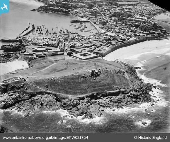
EPW021754 ENGLAND (1928). St Ives Head, the harbour and town, St Ives, from the north, 1928
© Hawlfraint cyfranwyr OpenStreetMap a thrwyddedwyd gan yr OpenStreetMap Foundation. 2025. Trwyddedir y gartograffeg fel CC BY-SA.
Delweddau cyfagos (2)
EPW021754

EAW004888

Manylion
| Pennawd | [EPW021754] St Ives Head, the harbour and town, St Ives, from the north, 1928 |
| Cyfeirnod | EPW021754 |
| Dyddiad | 24-June-1928 |
| Dolen | |
| Enw lle | ST IVES |
| Plwyf | ST. IVES |
| Ardal | |
| Gwlad | ENGLAND |
| Dwyreiniad / Gogleddiad | 151966, 41178 |
| Hydred / Lledred | -5.4773768509338, 50.217896509693 |
| Cyfeirnod Grid Cenedlaethol | SW520412 |