
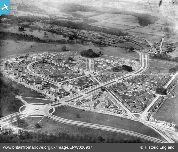
EPW020937 ENGLAND (1928). Middleton Boulevard, Wollaton, from the south-east, 1928
© Hawlfraint cyfranwyr OpenStreetMap a thrwyddedwyd gan yr OpenStreetMap Foundation. 2026. Trwyddedir y gartograffeg fel CC BY-SA.
Delweddau cyfagos (5)
EPW020937

EPW020936

EPW021829

EPW021830

EPW021831

Manylion
| Pennawd | [EPW020937] Middleton Boulevard, Wollaton, from the south-east, 1928 |
| Cyfeirnod | EPW020937 |
| Dyddiad | April-1928 |
| Dolen | |
| Enw lle | WOLLATON |
| Plwyf | |
| Ardal | |
| Gwlad | ENGLAND |
| Dwyreiniad / Gogleddiad | 454481, 339285 |
| Hydred / Lledred | -1.1890789748065, 52.947865098413 |
| Cyfeirnod Grid Cenedlaethol | SK545393 |
Pinnau

John Wass |
Sunday 14th of June 2015 03:24:37 PM |