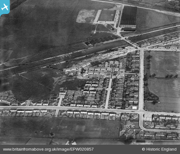
EPW020857 ENGLAND (1928). Norman Way and environs, Acton, 1928
    © Hawlfraint cyfranwyr OpenStreetMap a thrwyddedwyd gan yr OpenStreetMap Foundation. 2025. Trwyddedir y gartograffeg fel CC BY-SA.
  
Delweddau cyfagos (18)
Manylion
| Pennawd | [EPW020857] Norman Way and environs, Acton, 1928 | 
| Cyfeirnod | EPW020857 | 
| Dyddiad | May-1928 | 
| Dolen | |
| Enw lle | ACTON | 
| Plwyf | |
| Ardal | |
| Gwlad | ENGLAND | 
| Dwyreiniad / Gogleddiad | 519772, 181554 | 
| Hydred / Lledred | -0.27352633113955, 51.519708623725 | 
| Cyfeirnod Grid Cenedlaethol | TQ198816 | 
Pinnau
|  This area, until about 1920, was the London Aviation Ground (Acton Airfield) used for flight instruction in the early days of aviation and also utilised by the adjoining Alliance Aircraft Company factory.
It has since been developed as the Concord Business Centre and the Royale Leisure Park. |   The Laird | Thursday 28th of July 2016 12:52:46 PM | 
 
             
  ![[EPW020857] Norman Way and environs, Acton, 1928](http://britainfromabove.org.uk/sites/all/libraries/aerofilms-images/public/100x100/EPW/020/EPW020857.jpg) 
  
                                          ![[EPW020336] Walton Way, Acton, 1928](http://britainfromabove.org.uk/sites/all/libraries/aerofilms-images/public/100x100/EPW/020/EPW020336.jpg) 
 ![[EPW020338] Norman Way, Acton, 1928](http://britainfromabove.org.uk/sites/all/libraries/aerofilms-images/public/100x100/EPW/020/EPW020338.jpg) 
 ![[EPW020332] Walton Way and Public Playing Fields, Acton, 1928](http://britainfromabove.org.uk/sites/all/libraries/aerofilms-images/public/100x100/EPW/020/EPW020332.jpg) 
 ![[EPW020334] Norman Way, Acton, 1928](http://britainfromabove.org.uk/sites/all/libraries/aerofilms-images/public/100x100/EPW/020/EPW020334.jpg) 
 ![[EPW020337] Walton Way, Acton, 1928](http://britainfromabove.org.uk/sites/all/libraries/aerofilms-images/public/100x100/EPW/020/EPW020337.jpg) 
 ![[EPW020335] Noel Road and Moat Place, Acton, 1928](http://britainfromabove.org.uk/sites/all/libraries/aerofilms-images/public/100x100/EPW/020/EPW020335.jpg) 
 ![[EPW020331] Westfields Road and Public Playing Fields, Acton, 1928](http://britainfromabove.org.uk/sites/all/libraries/aerofilms-images/public/100x100/EPW/020/EPW020331.jpg) 
 ![[EPW020333] Norman Way and Public Playing Fields, Acton, 1928](http://britainfromabove.org.uk/sites/all/libraries/aerofilms-images/public/100x100/EPW/020/EPW020333.jpg) 
 ![[EPW020880] Housing development at Noel Road, Acton, 1928](http://britainfromabove.org.uk/sites/all/libraries/aerofilms-images/public/100x100/EPW/020/EPW020880.jpg) 
 ![[EPW021148] Noel Road and Acton Housing Estate, Acton, 1928](http://britainfromabove.org.uk/sites/all/libraries/aerofilms-images/public/100x100/EPW/021/EPW021148.jpg) 
 ![[EPW021151] Acton Housing Estate and Automobile Works, Acton, 1928](http://britainfromabove.org.uk/sites/all/libraries/aerofilms-images/public/100x100/EPW/021/EPW021151.jpg) 
 ![[EPW020878] Housing development at Noel Road, Acton, 1928](http://britainfromabove.org.uk/sites/all/libraries/aerofilms-images/public/100x100/EPW/020/EPW020878.jpg) 
 ![[EPW020882] Housing development at Noel Road and environs, Acton, 1928](http://britainfromabove.org.uk/sites/all/libraries/aerofilms-images/public/100x100/EPW/020/EPW020882.jpg) 
 ![[EPW020432] Housing development around Noel Road and the North Acton Playing Fields, Acton, 1928](http://britainfromabove.org.uk/sites/all/libraries/aerofilms-images/public/100x100/EPW/020/EPW020432.jpg) 
 ![[EPW047103] The Metal Box Co Factory, Acton, 1935](http://britainfromabove.org.uk/sites/all/libraries/aerofilms-images/public/100x100/EPW/047/EPW047103.jpg)