
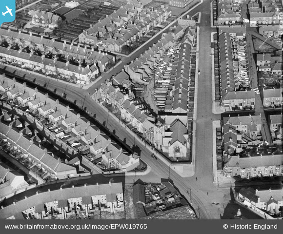
EPW019765 ENGLAND (1927). Margaret Road Methodist Church and environs, Whitley Bay, 1927
© Hawlfraint cyfranwyr OpenStreetMap a thrwyddedwyd gan yr OpenStreetMap Foundation. 2026. Trwyddedir y gartograffeg fel CC BY-SA.
Delweddau cyfagos (4)
EPW019765

EPW025031

EPW019772

EAW022859

Manylion
| Pennawd | [EPW019765] Margaret Road Methodist Church and environs, Whitley Bay, 1927 |
| Cyfeirnod | EPW019765 |
| Dyddiad | 18-October-1927 |
| Dolen | |
| Enw lle | WHITLEY BAY |
| Plwyf | |
| Ardal | |
| Gwlad | ENGLAND |
| Dwyreiniad / Gogleddiad | 436169, 571692 |
| Hydred / Lledred | -1.4339834391137, 55.038357064097 |
| Cyfeirnod Grid Cenedlaethol | NZ362717 |
Pinnau

Potter |
Saturday 8th of December 2018 12:51:31 AM | |
|
cheviotwalks |
Wednesday 15th of October 2014 11:21:13 PM | |
|
cheviotwalks |
Wednesday 15th of October 2014 11:20:04 PM | |

Class31 |
Monday 21st of January 2013 04:37:46 PM | |
|
Class31 |
Monday 21st of January 2013 04:36:05 PM | |
|
Class31 |
Monday 21st of January 2013 04:35:38 PM | |
|
Class31 |
Monday 21st of January 2013 04:35:09 PM | |
|
Class31 |
Monday 21st of January 2013 04:34:39 PM | |
|
Class31 |
Monday 21st of January 2013 04:34:16 PM | |
|
Class31 |
Monday 21st of January 2013 04:33:54 PM | |
|
Class31 |
Monday 21st of January 2013 04:33:19 PM | |
|
Eric Hollerton |
Thursday 15th of November 2012 03:39:53 PM |
Cyfraniadau Grŵp
Does anyone have any pictures or info on a shop possibly a sweet shop that used to be on egremont place? |
WHITLEY13 |
Sunday 24th of February 2013 11:17:14 PM |