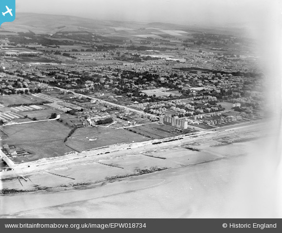
EPW018734 ENGLAND (1927). Grand Avenue and environs, Worthing, from the south-west, 1927
© Hawlfraint cyfranwyr OpenStreetMap a thrwyddedwyd gan yr OpenStreetMap Foundation. 2026. Trwyddedir y gartograffeg fel CC BY-SA.
Delweddau cyfagos (5)
Manylion
| Pennawd | [EPW018734] Grand Avenue and environs, Worthing, from the south-west, 1927 |
| Cyfeirnod | EPW018734 |
| Dyddiad | July-1927 |
| Dolen | |
| Enw lle | WORTHING |
| Plwyf | |
| Ardal | |
| Gwlad | ENGLAND |
| Dwyreiniad / Gogleddiad | 513214, 102111 |
| Hydred / Lledred | -0.39302969110595, 50.80691426938 |
| Cyfeirnod Grid Cenedlaethol | TQ132021 |
Pinnau

SophieWattsit |
Tuesday 9th of February 2021 10:56:19 PM |


![[EPW018734] Grand Avenue and environs, Worthing, from the south-west, 1927](http://britainfromabove.org.uk/sites/all/libraries/aerofilms-images/public/100x100/EPW/018/EPW018734.jpg)
![[EPW054047] Winchelsea Court, Marine Gardens and the town, West Worthing, from the south-east, 1937](http://britainfromabove.org.uk/sites/all/libraries/aerofilms-images/public/100x100/EPW/054/EPW054047.jpg)
![[EPW054048] The Towers apartment block and the town, West Worthing, from the south-east, 1937](http://britainfromabove.org.uk/sites/all/libraries/aerofilms-images/public/100x100/EPW/054/EPW054048.jpg)
![[EPW018731] Grand Avenue, West Worthing, from the south, 1927](http://britainfromabove.org.uk/sites/all/libraries/aerofilms-images/public/100x100/EPW/018/EPW018731.jpg)
![[EPW018733] Grand Avenue, West Worthing, 1927](http://britainfromabove.org.uk/sites/all/libraries/aerofilms-images/public/100x100/EPW/018/EPW018733.jpg)