
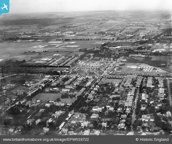
EPW018722 ENGLAND (1927). West Worthing and West Tarring, Worthing, from the south-east, 1927
© Hawlfraint cyfranwyr OpenStreetMap a thrwyddedwyd gan yr OpenStreetMap Foundation. 2026. Trwyddedir y gartograffeg fel CC BY-SA.
Delweddau cyfagos (2)
EPW018722

EPW011530

Manylion
| Pennawd | [EPW018722] West Worthing and West Tarring, Worthing, from the south-east, 1927 |
| Cyfeirnod | EPW018722 |
| Dyddiad | July-1927 |
| Dolen | |
| Enw lle | WORTHING |
| Plwyf | |
| Ardal | |
| Gwlad | ENGLAND |
| Dwyreiniad / Gogleddiad | 513451, 102848 |
| Hydred / Lledred | -0.38943923394526, 50.813493535202 |
| Cyfeirnod Grid Cenedlaethol | TQ135028 |
