
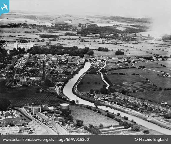
EPW018260 ENGLAND (1927). The River Arun and the town, Arundel, from the west, 1927. This image has been produced from a copy-negative.
© Hawlfraint cyfranwyr OpenStreetMap a thrwyddedwyd gan yr OpenStreetMap Foundation. 2025. Trwyddedir y gartograffeg fel CC BY-SA.
Delweddau cyfagos (3)
EPW018260

EPW017745

EPW000727

Manylion
| Pennawd | [EPW018260] The River Arun and the town, Arundel, from the west, 1927. This image has been produced from a copy-negative. |
| Cyfeirnod | EPW018260 |
| Dyddiad | 10-June-1927 |
| Dolen | |
| Enw lle | ARUNDEL |
| Plwyf | ARUNDEL |
| Ardal | |
| Gwlad | ENGLAND |
| Dwyreiniad / Gogleddiad | 501410, 106742 |
| Hydred / Lledred | -0.55923568421039, 50.850737301297 |
| Cyfeirnod Grid Cenedlaethol | TQ014067 |
Pinnau
Byddwch y cyntaf i ychwanegu sylw at y ddelwedd hon!