
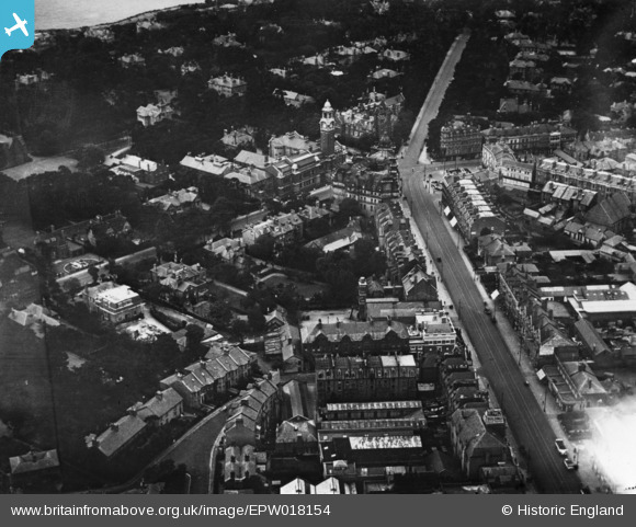
EPW018154 ENGLAND (1927). Holdenhurst Road and the Lansdowne Crescent junction, Bournemouth, 1927. This image has been produced from a print.
© Hawlfraint cyfranwyr OpenStreetMap a thrwyddedwyd gan yr OpenStreetMap Foundation. 2026. Trwyddedir y gartograffeg fel CC BY-SA.
Delweddau cyfagos (6)
EPW018154

EPR000660

EPW037417

EPW013557

EPW000251

EPW013568

Manylion
| Pennawd | [EPW018154] Holdenhurst Road and the Lansdowne Crescent junction, Bournemouth, 1927. This image has been produced from a print. |
| Cyfeirnod | EPW018154 |
| Dyddiad | 5-June-1927 |
| Dolen | |
| Enw lle | BOURNEMOUTH |
| Plwyf | |
| Ardal | |
| Gwlad | ENGLAND |
| Dwyreiniad / Gogleddiad | 409632, 91439 |
| Hydred / Lledred | -1.8635334937031, 50.721921936754 |
| Cyfeirnod Grid Cenedlaethol | SZ096914 |
Pinnau
Byddwch y cyntaf i ychwanegu sylw at y ddelwedd hon!