
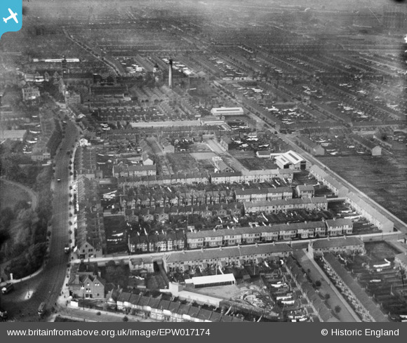
EPW017174 ENGLAND (1926). The area bounded by High Street South, Wellington Road and Flanders Road, East Ham, 1926
© Hawlfraint cyfranwyr OpenStreetMap a thrwyddedwyd gan yr OpenStreetMap Foundation. 2026. Trwyddedir y gartograffeg fel CC BY-SA.
Delweddau cyfagos (3)
EPW017174

EPW017176

EPW017175

Manylion
| Pennawd | [EPW017174] The area bounded by High Street South, Wellington Road and Flanders Road, East Ham, 1926 |
| Cyfeirnod | EPW017174 |
| Dyddiad | October-1926 |
| Dolen | |
| Enw lle | EAST HAM |
| Plwyf | |
| Ardal | |
| Gwlad | ENGLAND |
| Dwyreiniad / Gogleddiad | 542814, 183237 |
| Hydred / Lledred | 0.059086737651161, 51.529476831788 |
| Cyfeirnod Grid Cenedlaethol | TQ428832 |
Pinnau

brookfield |
Wednesday 10th of January 2018 10:56:04 PM | |
|
brookfield |
Wednesday 10th of January 2018 10:55:24 PM |