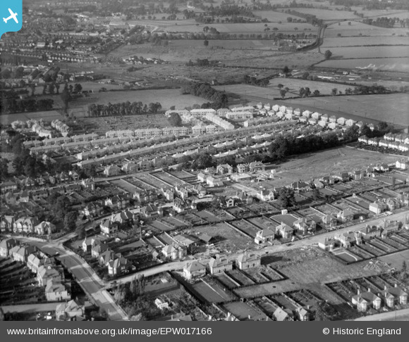
EPW017166 ENGLAND (1926). New housing around Gerard Road, Greenhill, 1926
    © Hawlfraint cyfranwyr OpenStreetMap a thrwyddedwyd gan yr OpenStreetMap Foundation. 2025. Trwyddedir y gartograffeg fel CC BY-SA.
  
Delweddau cyfagos (6)
Manylion
| Pennawd | [EPW017166] New housing around Gerard Road, Greenhill, 1926 | 
| Cyfeirnod | EPW017166 | 
| Dyddiad | October-1926 | 
| Dolen | |
| Enw lle | GREENHILL | 
| Plwyf | |
| Ardal | |
| Gwlad | ENGLAND | 
| Dwyreiniad / Gogleddiad | 516222, 188406 | 
| Hydred / Lledred | -0.32241002993685, 51.582040106073 | 
| Cyfeirnod Grid Cenedlaethol | TQ162884 | 
Pinnau
Byddwch y cyntaf i ychwanegu sylw at y ddelwedd hon!
 
             
  ![[EPW017166] New housing around Gerard Road, Greenhill, 1926](http://britainfromabove.org.uk/sites/all/libraries/aerofilms-images/public/100x100/EPW/017/EPW017166.jpg) 
  
                                          ![[EPW017165] New housing around Gerard Road, Greenhill, 1926](http://britainfromabove.org.uk/sites/all/libraries/aerofilms-images/public/100x100/EPW/017/EPW017165.jpg) 
 ![[EPW017167] New housing around Gerard Road and Crofts Road, Greenhill, 1926](http://britainfromabove.org.uk/sites/all/libraries/aerofilms-images/public/100x100/EPW/017/EPW017167.jpg) 
 ![[EPW018762] Flambard Road and environs, Greenhill, 1927](http://britainfromabove.org.uk/sites/all/libraries/aerofilms-images/public/100x100/EPW/018/EPW018762.jpg) 
 ![[EPW018760] Crofts Road and environs, Greenhill, 1927](http://britainfromabove.org.uk/sites/all/libraries/aerofilms-images/public/100x100/EPW/018/EPW018760.jpg) 
 ![[EPW025537] De Havilland DH60 Moth G-EBZT in flight over Greenhill, Harrow, 1928. This image has been produced from a damaged negative.](http://britainfromabove.org.uk/sites/all/libraries/aerofilms-images/public/100x100/EPW/025/EPW025537.jpg)