
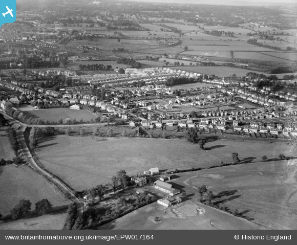
EPW017164 ENGLAND (1926). New housing around Flambard Road and environs, Greenhill, 1926
© Hawlfraint cyfranwyr OpenStreetMap a thrwyddedwyd gan yr OpenStreetMap Foundation. 2026. Trwyddedir y gartograffeg fel CC BY-SA.
Delweddau cyfagos (4)
EPW017164

EPW018761

EPW018762

EPW025537

Manylion
| Pennawd | [EPW017164] New housing around Flambard Road and environs, Greenhill, 1926 |
| Cyfeirnod | EPW017164 |
| Dyddiad | October-1926 |
| Dolen | |
| Enw lle | GREENHILL |
| Plwyf | |
| Ardal | |
| Gwlad | ENGLAND |
| Dwyreiniad / Gogleddiad | 516247, 188074 |
| Hydred / Lledred | -0.32215926773266, 51.579050759113 |
| Cyfeirnod Grid Cenedlaethol | TQ162881 |
Pinnau

The Laird |
Monday 28th of January 2013 09:27:27 PM | |
|
The Laird |
Monday 28th of January 2013 07:19:03 PM | |
|
The Laird |
Monday 28th of January 2013 07:13:18 PM | |
|
The Laird |
Monday 28th of January 2013 07:11:55 PM | |
|
DLJ |
Friday 14th of December 2012 02:32:56 AM | |
Probably still known as Sheepcote Lane at this time |
The Laird |
Tuesday 7th of January 2014 11:34:50 AM |
|
DLJ |
Friday 14th of December 2012 02:32:16 AM | |
|
DLJ |
Friday 14th of December 2012 02:31:12 AM | |
This section was once known as Tyburn Lane up to the junction with Kenton Lane/Woodcock Hill where the road continued as Kenton Lane to Kingsbury Green and beyond. A very short stub of Tyburn Lane still exists between Grove Hill Road and the Peterborough Hill/Station Road junction. |
The Laird |
Tuesday 7th of January 2014 11:43:14 AM |
|
DLJ |
Friday 14th of December 2012 02:30:53 AM | |
|
DLJ |
Friday 14th of December 2012 02:30:00 AM |