
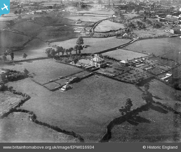
EPW016934 ENGLAND (1926). House and gardens off Courtney Road, Kingswood, 1926
© Hawlfraint cyfranwyr OpenStreetMap a thrwyddedwyd gan yr OpenStreetMap Foundation. 2026. Trwyddedir y gartograffeg fel CC BY-SA.
Delweddau cyfagos (3)
EPW016934

EPW016935

EPW016933

Manylion
| Pennawd | [EPW016934] House and gardens off Courtney Road, Kingswood, 1926 |
| Cyfeirnod | EPW016934 |
| Dyddiad | 13-September-1926 |
| Dolen | |
| Enw lle | KINGSWOOD |
| Plwyf | |
| Ardal | |
| Gwlad | ENGLAND |
| Dwyreiniad / Gogleddiad | 365374, 173340 |
| Hydred / Lledred | -2.4984278620394, 51.457489454099 |
| Cyfeirnod Grid Cenedlaethol | ST654733 |
Pinnau

tony way |
Wednesday 16th of October 2013 08:29:48 PM | |
|
knightley |
Thursday 23rd of May 2013 10:39:30 PM | |

Class31 |
Wednesday 11th of July 2012 08:47:32 PM | |
|
Class31 |
Wednesday 11th of July 2012 08:04:45 PM | |
The flagged house is no.24 Courtney Road. 2 chimneys on the gable end give it away. 110 is just off to the left of the photo. |
knightley |
Friday 15th of February 2013 09:26:41 PM |
Cyfraniadau Grŵp
View looking South-West. Main house in picture is believed demolished. I have found a house in Courtney Road which is extant as identified by a flag. Hanham Road is in the distance. |
Class31 |
Wednesday 11th of July 2012 08:54:26 PM |