
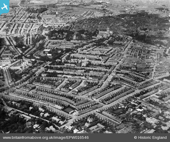
EPW016546 ENGLAND (1926). View of the city around Rupert Street, Norwich, from the south, 1926
© Hawlfraint cyfranwyr OpenStreetMap a thrwyddedwyd gan yr OpenStreetMap Foundation. 2026. Trwyddedir y gartograffeg fel CC BY-SA.
Delweddau cyfagos (2)
EPW016546

EPW016546
Manylion
| Pennawd | [EPW016546] View of the city around Rupert Street, Norwich, from the south, 1926 |
| Cyfeirnod | EPW016546 |
| Dyddiad | 26-August-1926 |
| Dolen | |
| Enw lle | NORWICH |
| Plwyf | |
| Ardal | |
| Gwlad | ENGLAND |
| Dwyreiniad / Gogleddiad | 622047, 307674 |
| Hydred / Lledred | 1.2808196857449, 52.620991624277 |
| Cyfeirnod Grid Cenedlaethol | TG220077 |
Pinnau

AdamR |
Tuesday 9th of June 2026 06:29:18 PM | |
|
Margaret Todd |
Thursday 17th of September 2020 02:17:12 PM | |
|
Chris Lambert |
Sunday 26th of April 2015 09:36:22 AM | |
|
Chris Lambert |
Sunday 26th of April 2015 09:35:23 AM | |
|
Chris Lambert |
Sunday 26th of April 2015 09:33:54 AM | |
|
Chris Lambert |
Sunday 26th of April 2015 09:33:09 AM | |
|
Chris Lambert |
Sunday 26th of April 2015 09:31:43 AM | |
|
Chris Lambert |
Saturday 18th of April 2015 08:23:50 PM | |
|
Chris Lambert |
Saturday 18th of April 2015 08:21:29 PM | |
|
Chris Lambert |
Saturday 18th of April 2015 08:20:31 PM | |

Class31 |
Wednesday 5th of September 2012 09:43:40 PM | |
|
Class31 |
Wednesday 5th of September 2012 09:43:08 PM | |
|
Class31 |
Wednesday 5th of September 2012 09:42:45 PM | |
|
Class31 |
Wednesday 5th of September 2012 09:42:24 PM | |
|
Class31 |
Wednesday 5th of September 2012 09:36:02 PM | |
|
Class31 |
Wednesday 5th of September 2012 09:35:05 PM | |
|
Class31 |
Wednesday 5th of September 2012 09:34:19 PM | |
|
Class31 |
Wednesday 5th of September 2012 09:33:26 PM |