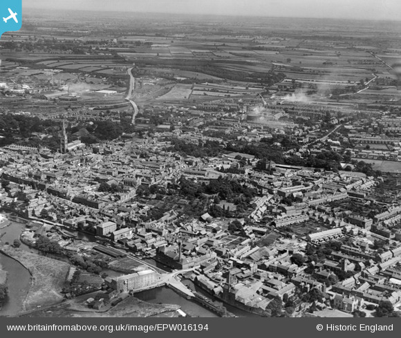
EPW016194 ENGLAND (1926). The town centre, Newark-on-Trent, from the west, 1926
© Hawlfraint cyfranwyr OpenStreetMap a thrwyddedwyd gan yr OpenStreetMap Foundation. 2026. Trwyddedir y gartograffeg fel CC BY-SA.
Delweddau cyfagos (6)
Manylion
| Pennawd | [EPW016194] The town centre, Newark-on-Trent, from the west, 1926 |
| Cyfeirnod | EPW016194 |
| Dyddiad | July-1926 |
| Dolen | |
| Enw lle | NEWARK-ON-TRENT |
| Plwyf | NEWARK |
| Ardal | |
| Gwlad | ENGLAND |
| Dwyreiniad / Gogleddiad | 479542, 353712 |
| Hydred / Lledred | -0.81257832758945, 53.074409007462 |
| Cyfeirnod Grid Cenedlaethol | SK795537 |
Pinnau

MB |
Sunday 6th of November 2016 06:20:28 PM | |

MB |
Sunday 6th of November 2016 06:19:17 PM | |

MB |
Sunday 6th of November 2016 06:18:40 PM | |

MB |
Sunday 6th of November 2016 06:18:14 PM | |

MB |
Sunday 6th of November 2016 06:16:53 PM | |

MB |
Sunday 6th of November 2016 06:15:23 PM | |

MB |
Sunday 6th of November 2016 06:14:04 PM | |
This was a cotton mill before its conversion to milling grain. More history here: http://www.ournottinghamshire.org.uk/page/the_cotton_mill_at_newark |

MB |
Sunday 6th of November 2016 10:14:55 PM |

MB |
Sunday 6th of November 2016 06:12:23 PM |


![[EPW016194] The town centre, Newark-on-Trent, from the west, 1926](http://britainfromabove.org.uk/sites/all/libraries/aerofilms-images/public/100x100/EPW/016/EPW016194.jpg)
![[EPW038063] The Trent Navigation Company warehouse on Mill Lane and environs, Newark-on-Trent, 1932](http://britainfromabove.org.uk/sites/all/libraries/aerofilms-images/public/100x100/EPW/038/EPW038063.jpg)
![[EPW038062] The Trent Navigation Company warehouse on Mill Lane and environs, Newark-on-Trent, 1932](http://britainfromabove.org.uk/sites/all/libraries/aerofilms-images/public/100x100/EPW/038/EPW038062.jpg)
![[EPW038061] The Trent Navigation Company warehouse on Mill Lane and environs, Newark-on-Trent, 1932](http://britainfromabove.org.uk/sites/all/libraries/aerofilms-images/public/100x100/EPW/038/EPW038061.jpg)
![[EAW016509] Newark Castle and Castle Gardens, the River Trent and Castle Gate, Newark-on-Trent, 1948. This image has been produced from a print.](http://britainfromabove.org.uk/sites/all/libraries/aerofilms-images/public/100x100/EAW/016/EAW016509.jpg)
![[EPW016196] Albert Street and environs, Newark-on-Trent, 1926](http://britainfromabove.org.uk/sites/all/libraries/aerofilms-images/public/100x100/EPW/016/EPW016196.jpg)