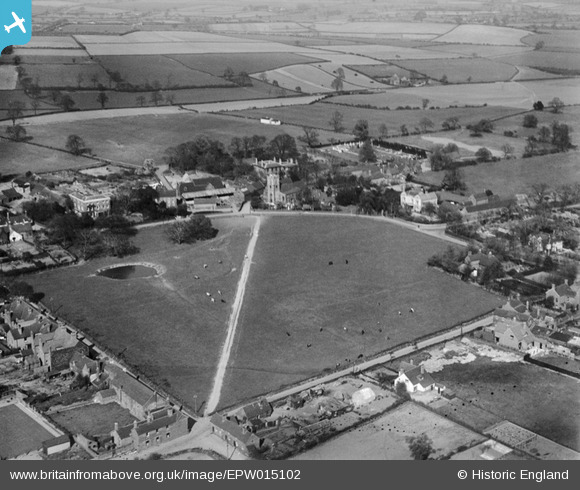
EPW015102 ENGLAND (1926). The Croft and St Mary's Church, Aldridge, from the south-west, 1926
© Hawlfraint cyfranwyr OpenStreetMap a thrwyddedwyd gan yr OpenStreetMap Foundation. 2026. Trwyddedir y gartograffeg fel CC BY-SA.
Manylion
| Pennawd | [EPW015102] The Croft and St Mary's Church, Aldridge, from the south-west, 1926 |
| Cyfeirnod | EPW015102 |
| Dyddiad | 12-April-1926 |
| Dolen | |
| Enw lle | ALDRIDGE |
| Plwyf | |
| Ardal | |
| Gwlad | ENGLAND |
| Dwyreiniad / Gogleddiad | 405902, 300616 |
| Hydred / Lledred | -1.9128442923766, 52.602943572156 |
| Cyfeirnod Grid Cenedlaethol | SK059006 |
Pinnau
Byddwch y cyntaf i ychwanegu sylw at y ddelwedd hon!
Cyfraniadau Grŵp

Barry Carpenter |
Thursday 22nd of November 2012 05:04:48 PM |


![[EPW015102] The Croft and St Mary's Church, Aldridge, from the south-west, 1926](http://britainfromabove.org.uk/sites/all/libraries/aerofilms-images/public/100x100/EPW/015/EPW015102.jpg)
![[EPW015104] The High Street and environs, Aldridge, from the west, 1926](http://britainfromabove.org.uk/sites/all/libraries/aerofilms-images/public/100x100/EPW/015/EPW015104.jpg)
