
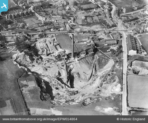
EPW014864 ENGLAND (1926). The Ashfield Fire Clay Works and Quarry, Conisbrough, 1926
© Hawlfraint cyfranwyr OpenStreetMap a thrwyddedwyd gan yr OpenStreetMap Foundation. 2026. Trwyddedir y gartograffeg fel CC BY-SA.
Delweddau cyfagos (2)
EPW014864

EPW015389

Manylion
| Pennawd | [EPW014864] The Ashfield Fire Clay Works and Quarry, Conisbrough, 1926 |
| Cyfeirnod | EPW014864 |
| Dyddiad | 5-April-1926 |
| Dolen | |
| Enw lle | CONISBROUGH |
| Plwyf | |
| Ardal | |
| Gwlad | ENGLAND |
| Dwyreiniad / Gogleddiad | 451428, 398301 |
| Hydred / Lledred | -1.2250012748778, 53.478666075212 |
| Cyfeirnod Grid Cenedlaethol | SK514983 |
Pinnau

MB |
Friday 22nd of January 2021 01:45:31 PM | |
|
MB |
Friday 22nd of January 2021 01:44:43 PM | |

Whitwellian |
Friday 28th of November 2014 01:35:38 PM | |
|
Brick Collector |
Sunday 22nd of June 2014 10:17:54 PM |