
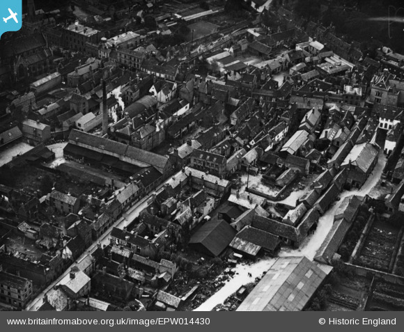
EPW014430 ENGLAND (1925). St Germain Street and environs, Huntingdon, 1925. This image has been produced from a print.
© Hawlfraint cyfranwyr OpenStreetMap a thrwyddedwyd gan yr OpenStreetMap Foundation. 2026. Trwyddedir y gartograffeg fel CC BY-SA.
Delweddau cyfagos (9)
EPW014430

EPW014431

EPW009841

EAW051770

EPW009849

EAW031902

EAW031903

EAW051768

EAW051769

Manylion
| Pennawd | [EPW014430] St Germain Street and environs, Huntingdon, 1925. This image has been produced from a print. |
| Cyfeirnod | EPW014430 |
| Dyddiad | 9-October-1925 |
| Dolen | |
| Enw lle | HUNTINGDON |
| Plwyf | HUNTINGDON |
| Ardal | |
| Gwlad | ENGLAND |
| Dwyreiniad / Gogleddiad | 523938, 271852 |
| Hydred / Lledred | -0.18098333363173, 52.330354135575 |
| Cyfeirnod Grid Cenedlaethol | TL239719 |


