
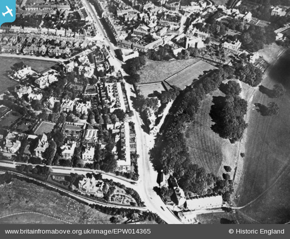
EPW014365 ENGLAND (1925). Stanwix Bank, Stanwix, 1925. This image has been produced from a copy-negative.
© Hawlfraint cyfranwyr OpenStreetMap a thrwyddedwyd gan yr OpenStreetMap Foundation. 2026. Trwyddedir y gartograffeg fel CC BY-SA.
Delweddau cyfagos (2)
EPW014365

EPW014355

Manylion
| Pennawd | [EPW014365] Stanwix Bank, Stanwix, 1925. This image has been produced from a copy-negative. |
| Cyfeirnod | EPW014365 |
| Dyddiad | 24-September-1925 |
| Dolen | |
| Enw lle | STANWIX |
| Plwyf | |
| Ardal | |
| Gwlad | ENGLAND |
| Dwyreiniad / Gogleddiad | 340010, 556855 |
| Hydred / Lledred | -2.935647427895, 54.902727038506 |
| Cyfeirnod Grid Cenedlaethol | NY400569 |
Pinnau

AnonEuMouse |
Thursday 21st of October 2021 09:22:46 AM | |

Philip |
Wednesday 20th of October 2021 11:58:11 AM | |
|
Philip |
Wednesday 20th of October 2021 11:55:27 AM | |
 |
AnonEuMouse |
Thursday 9th of September 2021 09:16:40 AM |
 |
AnonEuMouse |
Wednesday 12th of May 2021 06:20:33 AM |
|
AnonEuMouse |
Wednesday 12th of May 2021 06:15:36 AM | |
|
Sweet Pete |
Tuesday 29th of December 2015 05:18:39 PM | |
|
Sweet Pete |
Tuesday 29th of December 2015 05:16:43 PM | |
|
Sweet Pete |
Tuesday 29th of December 2015 05:14:12 PM | |
|
Sweet Pete |
Tuesday 29th of December 2015 05:13:21 PM | |
|
Sweet Pete |
Tuesday 29th of December 2015 05:12:21 PM |

