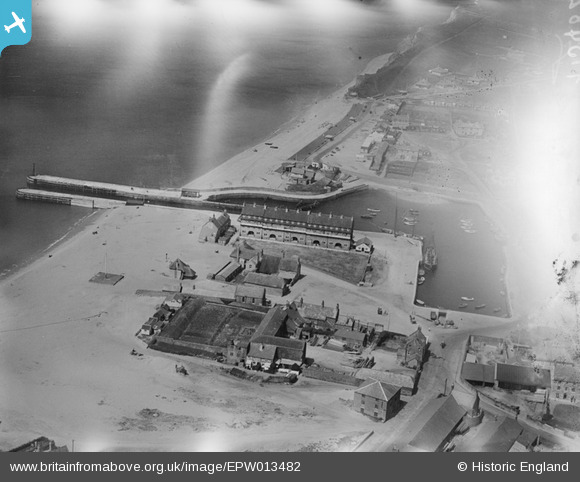
EPW013482 ENGLAND (1925). Bridport Harbour, West Bay, 1925
    © Hawlfraint cyfranwyr OpenStreetMap a thrwyddedwyd gan yr OpenStreetMap Foundation. 2025. Trwyddedir y gartograffeg fel CC BY-SA.
  
Delweddau cyfagos (10)
Manylion
| Pennawd | [EPW013482] Bridport Harbour, West Bay, 1925 | 
| Cyfeirnod | EPW013482 | 
| Dyddiad | July-1925 | 
| Dolen | |
| Enw lle | WEST BAY | 
| Plwyf | BRIDPORT | 
| Ardal | |
| Gwlad | ENGLAND | 
| Dwyreiniad / Gogleddiad | 346242, 90371 | 
| Hydred / Lledred | -2.7614548099423, 50.709909951278 | 
| Cyfeirnod Grid Cenedlaethol | SY462904 | 
Pinnau
|  Bridport Arms |   martynrb | Thursday 23rd of July 2020 04:53:55 AM | 
|   Alan McFaden | Saturday 12th of April 2014 10:00:07 AM | |
|   Alan McFaden | Saturday 12th of April 2014 09:58:51 AM | |
|   Alan McFaden | Saturday 12th of April 2014 09:57:32 AM | |
|   Alan McFaden | Saturday 12th of April 2014 09:56:06 AM | 
Cyfraniadau Grŵp
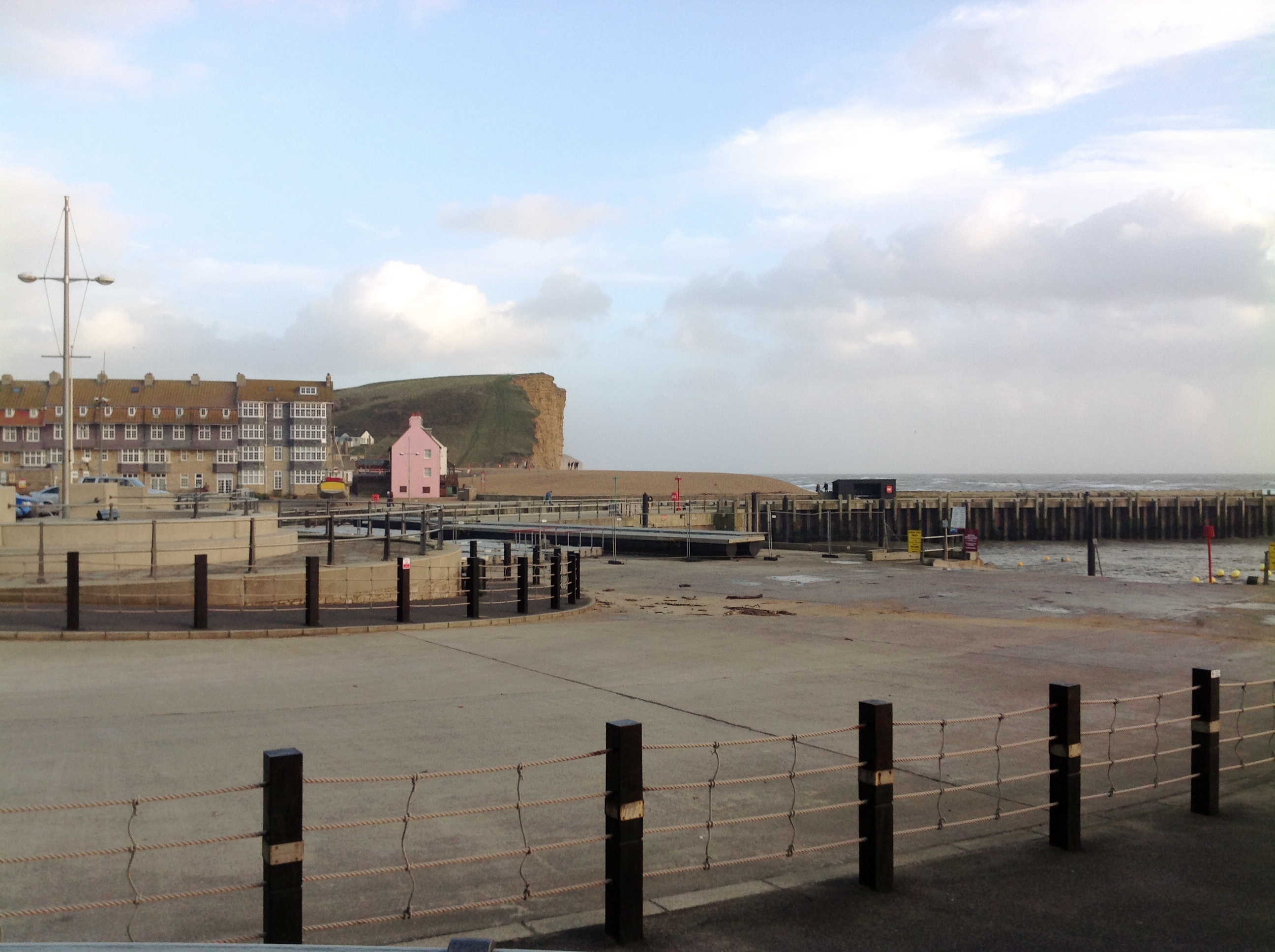
| View east from The Esplanade 01/02/2014 | Class31 | Monday 3rd of February 2014 11:15:09 AM | 
| Looking west from The Esplanade 01/02/2014 | Class31 | Monday 3rd of February 2014 11:13:31 AM | 
| Looking west from The Esplanade 01/02/2014 | Class31 | Monday 3rd of February 2014 11:10:51 AM | 
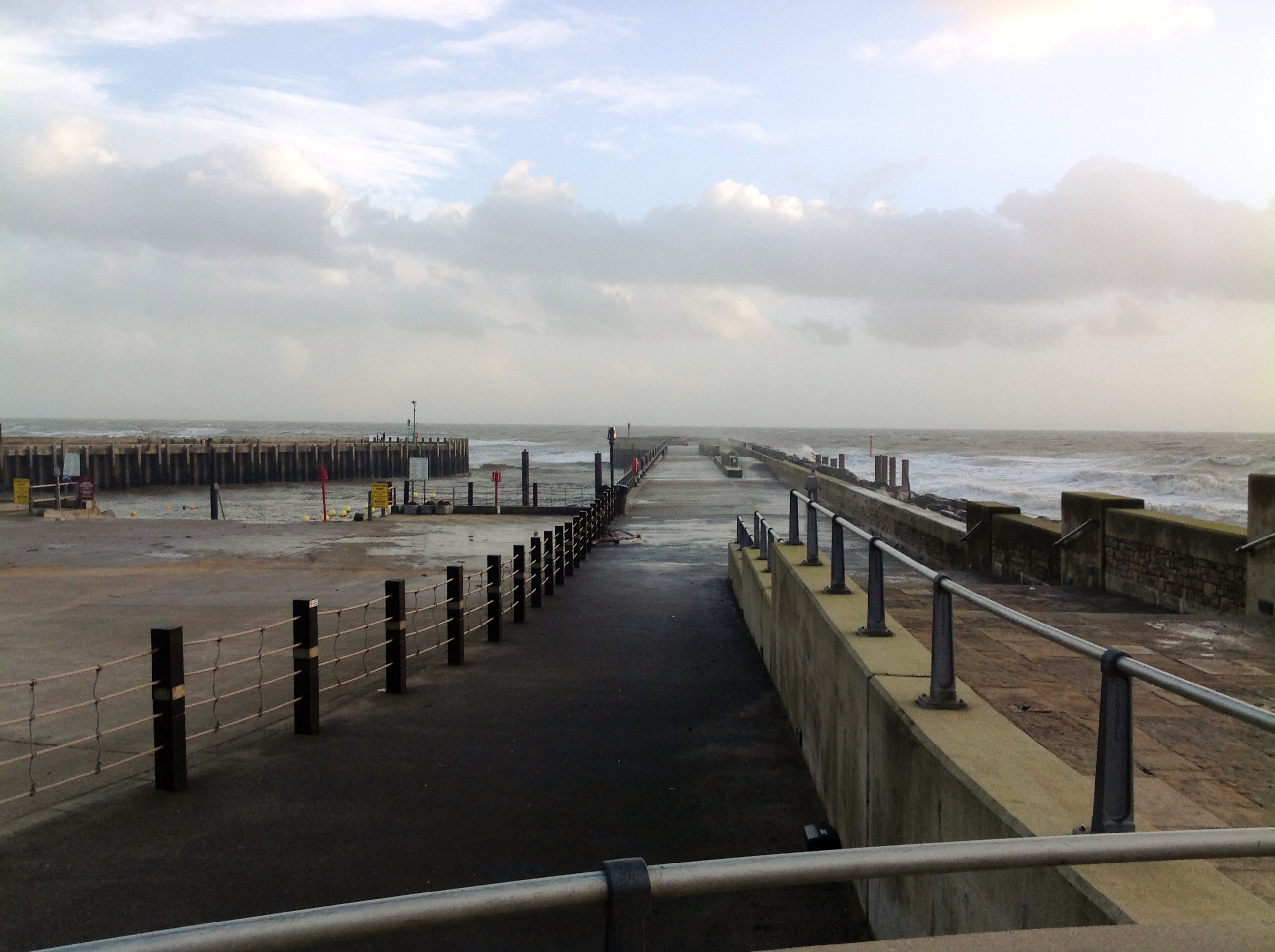
| Bridport Harbour looking seaward 01/02/2014 | Class31 | Monday 3rd of February 2014 11:09:24 AM | 
| Compare this with a modern view and see the extent of the  errosion that has taken place along the West Cliff. |   clippedwings | Wednesday 10th of April 2013 10:28:57 PM | 
 
             
  ![[EPW013482] Bridport Harbour, West Bay, 1925](http://britainfromabove.org.uk/sites/all/libraries/aerofilms-images/public/100x100/EPW/013/EPW013482.jpg) 
  
                                          ![[EAW047124] Bridport Harbour, West Bay, 1952](http://britainfromabove.org.uk/sites/all/libraries/aerofilms-images/public/100x100/EAW/047/EAW047124.jpg) 
 ![[EPW024053] Bridport Harbour, West Bay, 1928](http://britainfromabove.org.uk/sites/all/libraries/aerofilms-images/public/100x100/EPW/024/EPW024053.jpg) 
 ![[EPW024050] Bridport Harbour, West Bay, 1928](http://britainfromabove.org.uk/sites/all/libraries/aerofilms-images/public/100x100/EPW/024/EPW024050.jpg) 
 ![[EAW047123] Bridport Harbour, West Bay, 1952](http://britainfromabove.org.uk/sites/all/libraries/aerofilms-images/public/100x100/EAW/047/EAW047123.jpg) 
 ![[EPW024046] Bridport Harbour, West Bay, 1928](http://britainfromabove.org.uk/sites/all/libraries/aerofilms-images/public/100x100/EPW/024/EPW024046.jpg) 
 ![[EAW050062] Bridport Harbour and the Municipal Camping Ground, West Bay, 1953](http://britainfromabove.org.uk/sites/all/libraries/aerofilms-images/public/100x100/EAW/050/EAW050062.jpg) 
 ![[EPW024049] Bridport Harbour, West Bay, 1928](http://britainfromabove.org.uk/sites/all/libraries/aerofilms-images/public/100x100/EPW/024/EPW024049.jpg) 
 ![[EAW047125] Bridport Harbour, West Bay, 1952](http://britainfromabove.org.uk/sites/all/libraries/aerofilms-images/public/100x100/EAW/047/EAW047125.jpg) 
 ![[EAW050061] West Bay, the River Brit and environs, Bridport, from the south, 1953](http://britainfromabove.org.uk/sites/all/libraries/aerofilms-images/public/100x100/EAW/050/EAW050061.jpg) 


