
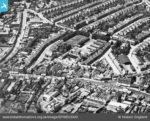
EPW013420 ENGLAND (1925). The High Street, Bruce Road and Salisbury Road, High Barnet, 1925. This image has been produced from a copy-negative.
© Hawlfraint cyfranwyr OpenStreetMap a thrwyddedwyd gan yr OpenStreetMap Foundation. 2026. Trwyddedir y gartograffeg fel CC BY-SA.
Delweddau cyfagos (5)
EPW013420

EAW053311

EAW013299

EPW013419

EPW001548

Manylion
| Pennawd | [EPW013420] The High Street, Bruce Road and Salisbury Road, High Barnet, 1925. This image has been produced from a copy-negative. |
| Cyfeirnod | EPW013420 |
| Dyddiad | June-1925 |
| Dolen | |
| Enw lle | HIGH BARNET |
| Plwyf | |
| Ardal | |
| Gwlad | ENGLAND |
| Dwyreiniad / Gogleddiad | 524393, 196704 |
| Hydred / Lledred | -0.20158080098953, 51.654877176059 |
| Cyfeirnod Grid Cenedlaethol | TQ244967 |
Pinnau
 [eBay} - Copy_0.jpg)
ChesterMan |
Friday 21st of August 2015 02:13:30 AM | |
|
ChesterMan |
Friday 21st of August 2015 02:09:39 AM | |
|
ChesterMan |
Friday 21st of August 2015 02:08:45 AM | |
|
ChesterMan |
Friday 21st of August 2015 02:07:43 AM | |
|
ChesterMan |
Friday 21st of August 2015 02:07:02 AM | |
|
ChesterMan |
Friday 21st of August 2015 02:06:32 AM | |
|
ChesterMan |
Friday 21st of August 2015 02:00:35 AM | |
|
ChesterMan |
Friday 21st of August 2015 01:59:48 AM | |
|
ChesterMan |
Friday 21st of August 2015 01:59:15 AM | |
|
ChesterMan |
Friday 21st of August 2015 01:58:33 AM |