
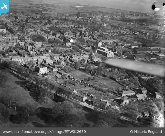
EPW012680 ENGLAND (1925). St Mary's Church and the town, Barton-upon-Humber, from the south-east, 1925
© Hawlfraint cyfranwyr OpenStreetMap a thrwyddedwyd gan yr OpenStreetMap Foundation. 2026. Trwyddedir y gartograffeg fel CC BY-SA.
Delweddau cyfagos (3)
EPW012680

EAW046162

EAW046051

Manylion
| Pennawd | [EPW012680] St Mary's Church and the town, Barton-upon-Humber, from the south-east, 1925 |
| Cyfeirnod | EPW012680 |
| Dyddiad | 6-May-1925 |
| Dolen | |
| Enw lle | BARTON-UPON-HUMBER |
| Plwyf | BARTON-UPON-HUMBER |
| Ardal | |
| Gwlad | ENGLAND |
| Dwyreiniad / Gogleddiad | 503497, 421763 |
| Hydred / Lledred | -0.4328024793351, 53.68183331313 |
| Cyfeirnod Grid Cenedlaethol | TA035218 |
Pinnau

Bartonian |
Saturday 6th of December 2014 07:33:23 PM | |

Class31 |
Wednesday 19th of November 2014 09:47:25 AM | |
|
Class31 |
Wednesday 19th of November 2014 09:46:11 AM | |
|
aerialandy |
Sunday 29th of June 2014 05:04:29 PM |


Cyfraniadau Grŵp
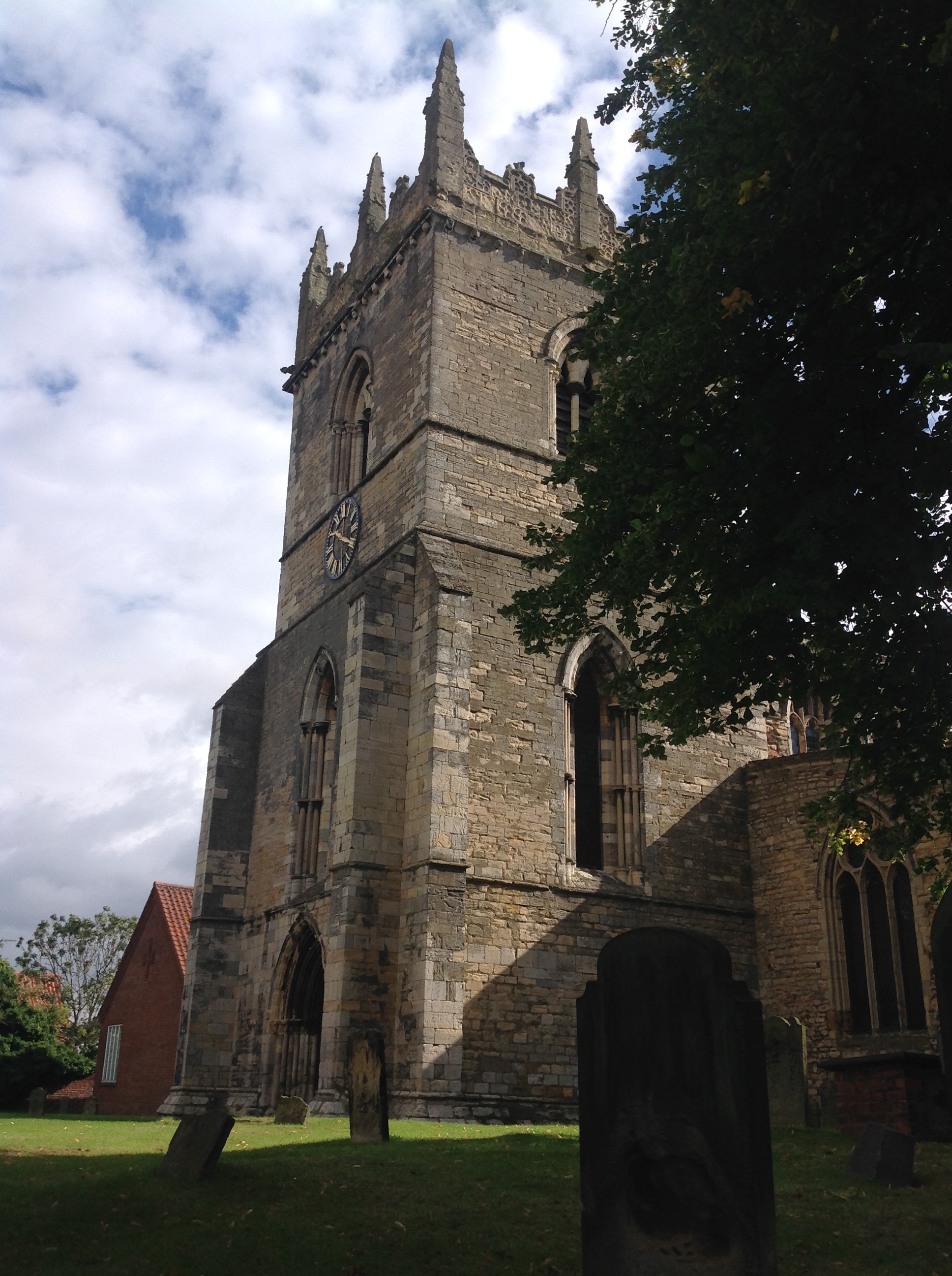
St. Mary's Church, Barton upon Humber, 29/08/2014 |
Class31 |
Wednesday 19th of November 2014 09:44:29 AM |
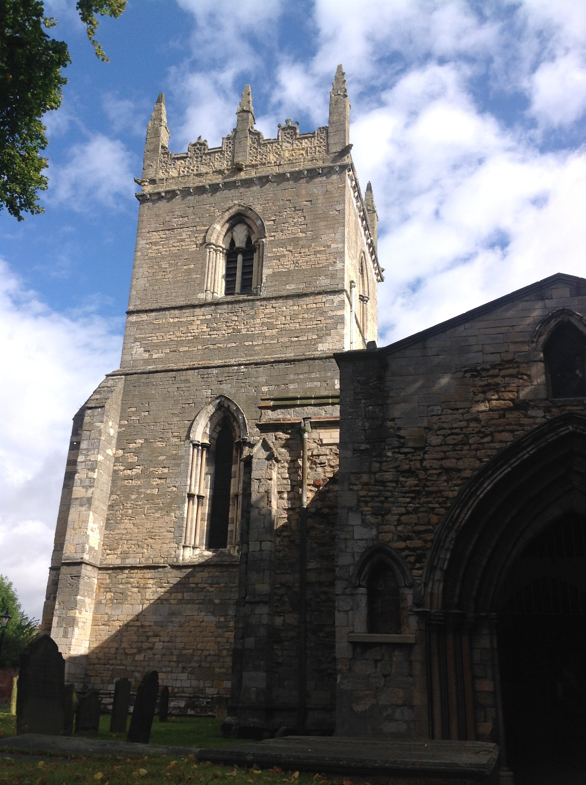
St. Mary's Church, Barton upon Humber, 29/08/2014 |
Class31 |
Wednesday 19th of November 2014 09:44:02 AM |
Field in foreground now site of several bungalows built in 1950s to early 1960's |
Bartonian |
Friday 19th of September 2014 01:18:05 PM |