
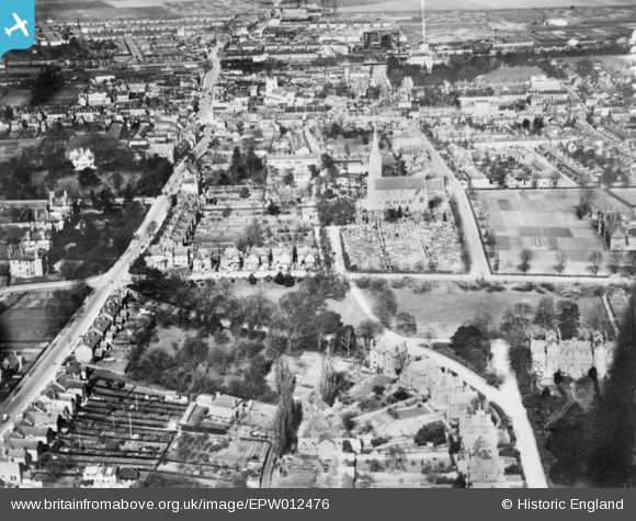
EPW012476 ENGLAND (1925). St Mary's Church, Windsor Road and environs, Slough, 1925. This image has been produced from a copy-negative.
© Hawlfraint cyfranwyr OpenStreetMap a thrwyddedwyd gan yr OpenStreetMap Foundation. 2026. Trwyddedir y gartograffeg fel CC BY-SA.
Delweddau cyfagos (6)
EPW012476

EPW012476A

EPW056576

EPR000475

EAW029472

EPW012477

Manylion
| Pennawd | [EPW012476] St Mary's Church, Windsor Road and environs, Slough, 1925. This image has been produced from a copy-negative. |
| Cyfeirnod | EPW012476 |
| Dyddiad | April-1925 |
| Dolen | |
| Enw lle | SLOUGH |
| Plwyf | |
| Ardal | |
| Gwlad | ENGLAND |
| Dwyreiniad / Gogleddiad | 497540, 179518 |
| Hydred / Lledred | -0.59444112678126, 51.505683364195 |
| Cyfeirnod Grid Cenedlaethol | SU975795 |
Pinnau

sciencefish |
Wednesday 3rd of February 2021 10:09:09 PM | |
|
dave43 |
Friday 2nd of January 2015 09:06:27 PM | |
|
dave43 |
Friday 2nd of January 2015 09:05:48 PM | |
|
dave43 |
Friday 2nd of January 2015 09:05:15 PM | |
|
dave43 |
Friday 2nd of January 2015 09:04:28 PM | |
|
dave43 |
Friday 2nd of January 2015 09:03:47 PM |