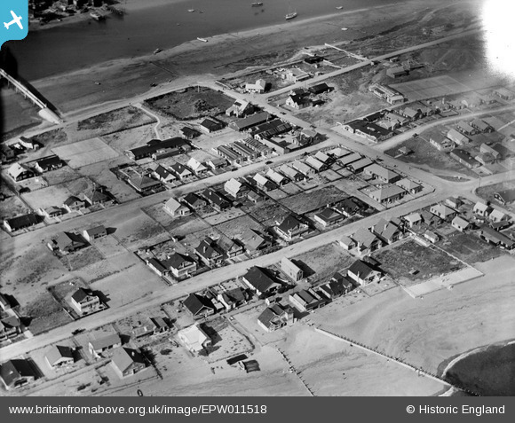
EPW011518 ENGLAND (1924). The Meadway and environs, Shoreham-by-Sea, 1924
    © Hawlfraint cyfranwyr OpenStreetMap a thrwyddedwyd gan yr OpenStreetMap Foundation. 2025. Trwyddedir y gartograffeg fel CC BY-SA.
  
Delweddau cyfagos (5)
Manylion
| Pennawd | [EPW011518] The Meadway and environs, Shoreham-by-Sea, 1924 | 
| Cyfeirnod | EPW011518 | 
| Dyddiad | July-1924 | 
| Dolen | |
| Enw lle | SHOREHAM-BY-SEA | 
| Plwyf | |
| Ardal | |
| Gwlad | ENGLAND | 
| Dwyreiniad / Gogleddiad | 521711, 104616 | 
| Hydred / Lledred | -0.27164775822829, 50.827709736004 | 
| Cyfeirnod Grid Cenedlaethol | TQ217046 | 
Pinnau
|   Alan McFaden | Monday 2nd of December 2013 08:48:21 PM | |
|   Alan McFaden | Monday 2nd of December 2013 08:46:32 PM | 
 
             
  ![[EPW011518] The Meadway and environs, Shoreham-by-Sea, 1924](http://britainfromabove.org.uk/sites/all/libraries/aerofilms-images/public/100x100/EPW/011/EPW011518.jpg) 
  
                                          ![[EAW022247] Shoreham Beach, Shoreham Harbour and the town, Shoreham-by-Sea, from the south-east, 1949](http://britainfromabove.org.uk/sites/all/libraries/aerofilms-images/public/100x100/EAW/022/EAW022247.jpg) 
 ![[EAW022246] Shoreham Beach, Shoreham Harbour and the town, Shoreham-by-Sea, from the south-east, 1949](http://britainfromabove.org.uk/sites/all/libraries/aerofilms-images/public/100x100/EAW/022/EAW022246.jpg) 
 ![[EPW018711] Shoreham Beach and the drawbridge, Shoreham-by-Sea, 1927](http://britainfromabove.org.uk/sites/all/libraries/aerofilms-images/public/100x100/EPW/018/EPW018711.jpg) 
 ![[EPW018713] Shoreham Beach and the drawbridge, Shoreham-by-Sea, 1927](http://britainfromabove.org.uk/sites/all/libraries/aerofilms-images/public/100x100/EPW/018/EPW018713.jpg) 
 
 New Adur Ferry Bridge Nov 2013
 New Adur Ferry Bridge Nov 2013