
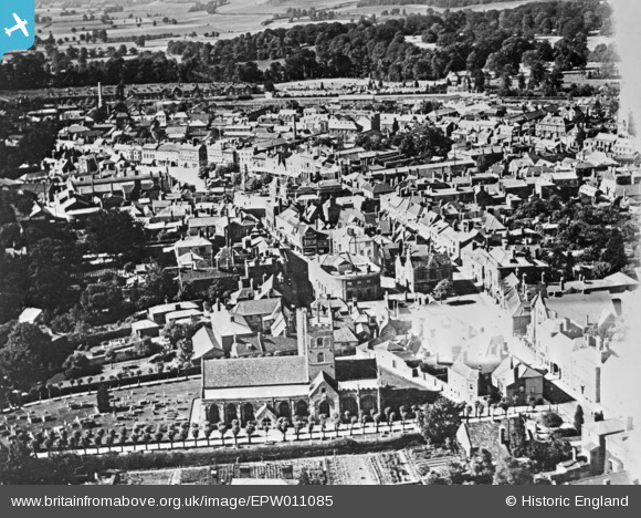
EPW011085 ENGLAND (1924). St John the Baptist's Church and the town centre, Devizes, 1924. This image has been produced from a copy-negative.
© Hawlfraint cyfranwyr OpenStreetMap a thrwyddedwyd gan yr OpenStreetMap Foundation. 2026. Trwyddedir y gartograffeg fel CC BY-SA.
Delweddau cyfagos (17)
EPW011085

EAW015072

EAW015073

EPW011089

EAW034906

EAW034904

EPW011084

EAW034908

EAW015074

EAW034907

EPW011088

EAW015071

EAW015075

EAW015076

EAW034905

EPW011093

EPW011086

Manylion
| Pennawd | [EPW011085] St John the Baptist's Church and the town centre, Devizes, 1924. This image has been produced from a copy-negative. |
| Cyfeirnod | EPW011085 |
| Dyddiad | July-1924 |
| Dolen | |
| Enw lle | DEVIZES |
| Plwyf | DEVIZES |
| Ardal | |
| Gwlad | ENGLAND |
| Dwyreiniad / Gogleddiad | 400455, 161378 |
| Hydred / Lledred | -1.9934656662829, 51.350978474953 |
| Cyfeirnod Grid Cenedlaethol | SU005614 |
Pinnau
Byddwch y cyntaf i ychwanegu sylw at y ddelwedd hon!